
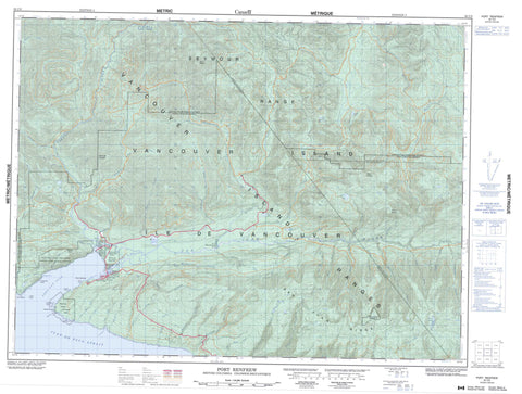
092C09 Port Renfrew Canada topo map, 1:50,000 scale
092C09 Port Renfrew NRCAN topographic map.
Includes UTM and GPS geographic coordinates (latitude and longitude). This 50k scale map is suitable for hiking, camping, and exploring, or you could frame it as a wall map.
Printed on-demand using high resolution, on heavy weight and acid free paper, or as an upgrade on a variety of synthetic materials.
Topos available on paper, Waterproof, Poly, or Tyvek. Usually shipping rolled, unless combined with other folded maps in one order.
- Product Number: NRCAN-092C09
- Parent Topo: TOPO-092C
- Map ID also known as: 092C09, 92C9, 92C09
- Unfolded Size: Approximately 26" high by 36" wide
- Weight (paper map): ca. 55 grams
- Map Type: POD NRCAN Topographic Map
- Map Scale: 1:50,000
- Geographical region: British Columbia, Canada
Neighboring Maps:
All neighboring Canadian topo maps are available for sale online at 1:50,000 scale.
Purchase the smaller scale map covering this area: Topo-092C
Spatial coverage:
Topo map sheet 092C09 Port Renfrew covers the following places:
- Harris Cove - Port San Juan - Providence Cove - Snuggery Cove - Thrasher Cove - Botanical Beach - Adze Head - Owen Point - San Juan Point - Woods Nose - Juan de Fuca Strait - Renfrew Land District - Gordon River Indian Reserve 2 - Pacheena Indian Reserve 1 - Queesidaquah Indian Reserve 4 - Réserve indienne Gordon River 2 - Réserve indienne Pacheena 1 - Réserve indienne Queesidaquah 4 - Île de Vancouver - Owen Island - Vancouver Island - Dimple Lake - Doe Lake - Fairy Lake - Lizard Lake - Maid Lake - Pixie Lake - Wye Lake - Edinburgh Mountain - Mount Bolduc - Mount Demers - Mount Modeste - Pandora Peak - San Juan Ridge - Seymour Range - Seymour Ridge - Vancouver Island Mountains - Vancouver Island Ranges - Capital Regional District - Cowichan Valley Regional District - Botanical Beach Park - Pacific Rim National Park Reserve of Canada - Parkinson Creek Park - Réserve de parc national du Canada Pacific Rim - 150 Yard Creek - Allan Creek - Axe Creek - Baird Creek - Bavis Creek - Blakeney Creek - Braden Creek - Browns Creek - Bugaboo Creek - Camper Creek - Cedarn Creek - Clydeside Creek - Coal Creek - Cullite Creek - Dent Creek - Fairy Creek - Falls Creek - Fleet River - Gain Creek - Garbage Creek - Gordon River - Grierson Creek - Hal Creek - Harris Creek - Hemmingsen Creek - Hobbs Creek - Jack Elliott Creek - Kuitsche Creek - Lens Creek - Log Jam Creek - Lorimer Creek - Loss Creek - Loup Creek - Mercer Creek - Minute Creek - Mosquito Creek - Murton Creek - Noyse Creek - Parkinson Creek - Payzant Creek - Red Creek - Reid Creek - Renfrew Creek - Robertson Creek - Robertson River - Sam Creek - San Juan River - Sombrio River - Soule Creek - Three Arm Creek - Tom Baird Creek - Walbran Creek - Wiggs Creek - Williams Creek - Wye Creek - Yauh Creek - West Coast Trail - Cerantes (Observatory) Rock - Cerantes Rocks - Hammond Rocks - Kellett Rock - Quartertide Rocks - Port Renfrew


