
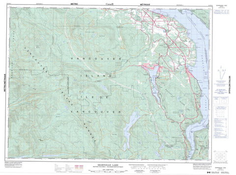
092B12 Shawnigan Lake Canada topo map, 1:50,000 scale
092B12 Shawnigan Lake NRCAN topographic map.
Includes UTM and GPS geographic coordinates (latitude and longitude). This 50k scale map is suitable for hiking, camping, and exploring, or you could frame it as a wall map.
Printed on-demand using high resolution, on heavy weight and acid free paper, or as an upgrade on a variety of synthetic materials.
Topos available on paper, Waterproof, Poly, or Tyvek. Usually shipping rolled, unless combined with other folded maps in one order.
- Product Number: NRCAN-092B12
- Parent Topo: TOPO-092B
- Map ID also known as: 092B12, 92B12
- Unfolded Size: Approximately 26" high by 36" wide
- Weight (paper map): ca. 55 grams
- Map Type: POD NRCAN Topographic Map
- Map Scale: 1:50,000
- Geographical region: British Columbia, Canada
Neighboring Maps:
All neighboring Canadian topo maps are available for sale online at 1:50,000 scale.
Purchase the smaller scale map covering this area: Topo-092B
Spatial coverage:
Topo map sheet 092B12 Shawnigan Lake covers the following places:
- Camp Bight - Cowichan Bay - Finlayson Arm - McKenzie Bight - Mill Bay - Misery Bay - Quarry Bay - Saanich Inlet - West Arm - Cherry Point - Christmas Point - Elbow Point - Hatch Point - Lenfesty Point - McCurdy Point - McPhail Point - Mitchell Point - Musgrave Point - Saanich Peninsula - Separation Point - Sheppard Point - Verdier Point - Whisky Point - Sansum Narrows - Satellite Channel - Highlands - West Leech Falls - Helmcken Land District - Malahat Land District - Shawnigan Land District - Cowichan Indian Reserve 1 - Est-patrolas Indian Reserve 4 - Hatch Point Indian Reserve 12 - Kil-pah-las Indian Reserve 3 - Malahat Indian Reserve 11 - Réserve indienne Cowichan 1 - Réserve indienne Est-patrolas 4 - Réserve indienne Hatch Point 12 - Réserve indienne Kil-pah-las 3 - Réserve indienne Malahat 11 - Réserve indienne Theik 2 - Theik Indian Reserve 2 - Île de Vancouver - Saltspring Island - Sawluctus Island - Vancouver Island - Bear Creek Reservoir - Begbie Lake - Butchart Lake - Council Lake - Devereux Lake - Diversion Reservoir - Dougan Lake - Goldstream Lake - Grant Lake - Horton Lake - Hutchinson Lake - Jarvis Lake - Keating Lake - Lois Lake - Lubbe Lake - Macdonald Lake - Mitchell Lake - Old Wolf Lake - Oliphant Lake - Patrolas Lake - Rogers Lake - Second Lake - Shawnigan Lake - Silver Mine Lakes - Sooke Lake - Spectacle Lake - Tadjiss Lake - Third Lake - Weeks Lake - Wild Deer Lake - Wrigglesworth Lake - Champ de tir Anse de Saanich - Saanich Inlet Range - Cobble Hill - Eagle Heights - Gowlland Range - Holmes Peak - Jocelyn Hill - Koksilah Ridge - Lone Tree Hill - Malahat Ridge - Mount Healey - Mount Jeffrey - Mount Lazar - Mount Todd - Mount Wood - Old Baldy Mountain - Padur Ridge - Seymour Range - Seymour Ridge - Sheepshanks Hill - Sooke Hills - Survey Mountain - Tunnel Hill - Valentine Mountain - Vancouver Island Mountains - Vancouver Island Ranges - Warwick Range - Waterloo Mountain - Capital Regional District - Cowichan Valley Regional District - Bamberton Park - Bright Angel Park - Gowlland Tod Park - Koksilah River Park - Memory Island Park - Shawnigan Lake Park - Spectacle Lake Park - West Shawnigan Lake Park - Arbutus Creek - Bamber Creek - Bear Creek - Bear Creek - Bird Creek - Boucicault Creek - Camsusa Creek - Clapp Creek - Colpman Creek - Council Creek - Cragg Creek - Fellows Creek - Floodwood Creek - Garnett Creek - Glenora Creek - Handysen Creek - Hazlitt Creek - Heather Bank Brook - Hollings Creek - Holt Creek - Humes Creek - Irving Creek - Johns Creek - Jordan River - Judge Creek - Kelvin Creek - Koksilah River - Leech River - Macdonald Creek - Malahat Creek - Manley Creek - McGee Creek - Mill Stream - Neel Creek - Niagara Creek - Patrolas Creek - Pease Creek - Rithet Creek - San Juan River - Shawnigan Creek - Sooke River - Spectacle Creek - Tripp Creek - Van Horne Creek - Walker Creek - West Leech River - Wheelbarrow Creek - Wild Deer Creek - Williamson Creek - Squally Reach - Boatswain Bank - Musgrave Rock - Patey Rock - Repulse Rock - Tanner Rock - Tozier Rock - Bamberton - Cliffside - Cobble Hill - Cowichan Bay - Cowichan Bay - Cowichan Station - Fairbridge - Hillbank - Kapoor - Kaptara - Kinsol - Lakend - Malahat - Malahat - Mill Bay - Musgrave - Musgrave Landing - Shawnigan - Shawnigan Beach - Shawnigan Lake - Strathcona Lodge - Wilby - Deception Gulch - Martins Gulch - Jordan Meadows


