
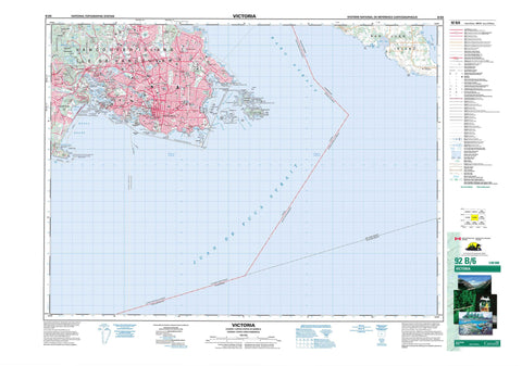
092B06 Victoria Canada topo map, 1:50,000 scale
092B06 Victoria NRCAN topographic map.
Includes UTM and GPS geographic coordinates (latitude and longitude). This 50k scale map is suitable for hiking, camping, and exploring, or you could frame it as a wall map.
Printed on-demand using high resolution, on heavy weight and acid free paper, or as an upgrade on a variety of synthetic materials.
Topos available on paper, Waterproof, Poly, or Tyvek. Usually shipping rolled, unless combined with other folded maps in one order.
- Product Number: NRCAN-092B06
- Parent Topo: TOPO-092B
- Map ID also known as: 092B06, 92B6, 92B06
- Unfolded Size: Approximately 26" high by 36" wide
- Weight (paper map): ca. 55 grams
- Map Type: POD NRCAN Topographic Map
- Map Scale: 1:50,000
- Geographical region: British Columbia, Canada
Neighboring Maps:
All neighboring Canadian topo maps are available for sale online at 1:50,000 scale.
Purchase the smaller scale map covering this area: Topo-092B
Spatial coverage:
Topo map sheet 092B06 Victoria covers the following places:
- Arbutus Cove - Cadboro Bay - Constance Cove - Cordova Bay - Dunns Nook - Esquimalt Harbour - Finnerty Cove - Fleming Bay - Flotsam Cove - Foul Bay - Funnel Cove - Glencoe Cove - Gonzales Bay - Gorge Waters - Helmcken Cove - Inner Harbour - Inspiration Cove - James Bay - Lang Cove - Lime Bay - Limekiln Cove - Loon Bay - Margaret Bay - Maynard Cove - McNeill Bay - Oak Bay - Parry Bay - Pilgrim Cove - Plumper Bay - Portage Inlet - Price Bay - Puget Cove - Rock Bay - Rose Bay - Ross Bay - Royal Roads - Rudlin Bay - Selkirk Water - Sheep Cove - Spoon Bay - St. Margaret Bay - Telegraph Cove - Thetis Cove - Tovey Bay - Upper Harbour - Vantreight Cove - Victoria Harbour - West Bay - Willows Beach - Aaron Point - Albert Head - Ashe Head - Barclay Point - Black Rock - Cadboro Point - Camel Point - Cape Saxe - Cattle Point - Channel Point - Chapman Point - Christie Point - Clover Point - Coburg Peninsula - Coffin Island Point - Commodore Point - Cormorant Point - Duntze Head - Dyke Point - Finlayson Point - Flamborough Head - Foul Point - Gonzales Point - Gordon Head - Gotha Point - Halkett Head - Harling Point - Heritage Point - Holland Point - Hope Point - Laurel Point - Limit Point - Macaulay Point - Maple Point - McLoughlin Point - McMicking Point - Munroe Head - Ogden Point - Paterson Point - Point Ellice - Raymur Point - Rodd Point - Royal Point - Saanich Peninsula - Saxe Point - Sea Bird Point - Seabird Point - Ship Point - Shoal Point - Skegness - Songhees Point - Spurn Head - Staines Point - Ten Mile Point - The Naze - Turkey Head - Wark Point - Work Point - Yew Point - Baynes Channel - Enterprise Channel - Haro Strait - Hecate Passage - Juan de Fuca Strait - Mayor Channel - Mouat Channel - Paddy Passage - Plumper Passage - The Gorge - Colwood - Langford - Victoria - Dallas Bank - Esquimalt - Highlands - Metchosin - Oak Bay - Saanich - Cowichan Land District - Esquimalt Land District - Highland Land District - Lake Land District - Victoria Land District - Chatham Islands Indian Reserve 4 - Discovery Island Indian Reserve 3 - Esquimalt Indian Reserve - New Songhees Indian Reserve 1A - Réserve indienne Chatham Islands 4 - Réserve indienne Discovery Island 3 - Réserve indienne Esquimalt - Réserve indienne New Songhees 1A - Alpha Islet - Berens Island - Brothers Islands - Chain Islets - Chatham Islands - Coffin Island - Cole Island - Colvile Island - Colville Island - Discovery Island - Emily Islet - Evans Island - Fisgard Island - Flower Island - Gillingham Islands - Great Chain Island - Griffin Island - Halkett Island - Harris Island - Harrison Island - Île de Vancouver - Inskip Islands - Jemmy Jones Island - Kitty Islet - Macarthy Island - Mary Tod Island - McCarthy Island - Pelly Island - Richards Island - Smart Island - Staines Island - Strongtide Islet - Trial Islands - Vancouver Island - Vantreight Island - Work Island - Albert Head Lagoon - Beckwith Pond - Blenkinsop Lake - Colwood Lake - Esquimalt Lagoon - Goodacre Lake - Maltby Lake - McKenzie Lake - Pike Lake - Prior Lake - Swan Lake - Thetis Lake - Trevlac Pond - Albert Head Battery Point Training Area - Base des Forces canadiennes Esquimalt - Canadian Forces Base Esquimalt - Champ de manoeuvre Albert Head Battery Point - Anderson Hill - Beacon Hill - Christmas Hill - Golf Hill - Gonzales Hill - Gowlland Range - Grant Knoll - Highrock - Knockan Hill - Mill Hill - Mount Douglas - Mount Tolmie - Pandora Hill - Peacock Hill - Prevost Hill - Rodd Hill - Scafe Hill - Seymour Hill - Signal Hill - Smith Hill - Capital Regional District - Discovery Island Marine Park - Esquimalt Lagoon Bird Sanctuary - Fisgard Lighthouse National Historic Site of Canada - Fort Rodd Hill National Historic Park - Fort Rodd Hill National Historic Site of Canada - Freeman King Park - Helmcken Centennial Park - Lieu historique national du Canada du Fort Rodd Hill - Lieu historique national du Canada du Phare-de-Fisgard - Newstead Park - Parc historique national du Fort-Rodd Hill - Refuge d'oiseaux d'Esquimalt-Lagoon - Refuge d'oiseaux du havre de Victoria - Thomas S. Francis Park - Victoria Harbour Bird Sanctuary - Panama Flats - British Columbia - Colombie-Britannique - Bowker Creek - Colquitz River - Colwood Creek - Craigflower Creek - Deadman Creek - Mill Stream - Swan Lake Creek - Trevlac Brook - Viaduct Creek - Beaumont Shoal - Brinn Rock - Brodie Rock - Brotchie Ledge - Carolina Reef - Caroline Reef - Coghlan Rock - Constance Bank - Discovery Rock - Evans Rock - Fiddle Reef - Fulford Reef - Glimpse Reefs - Gordon Rock - Johnstone Reef - Johnstone Rock - Lee Rock - Lewis Reef - Malacca Patch - Mouat Reef - Robson Reef - Scrogg Rocks - Scroggs Rocks - Sister Rocks - Sleeper Rock - Spencer Ledge - Templar Rock - Thames Shoal - Tod Rock - Tuzo Rock - Village Rocks - Virtue Rock - Whale Rock - View Royal - Admirals - Admirals Road - Albert Head - Alpha Street - Beaumont - Belmont Park - Cadboro Bay - Colquitz - Craigflower - Esquimalt - Esquimalt Siding - Fairfield - Glyn - Gordon Head - James Bay - Lagoon - Lake Hill - Langford Station - Marigold - Mount Tolmie - Mount Tolmie - Palmer - Royal Oak - Russells - Sevenoaks - Strawberry Vale - Thoburn - Tillicum - Wye - Quicks Bottom - Rithets Bog


