
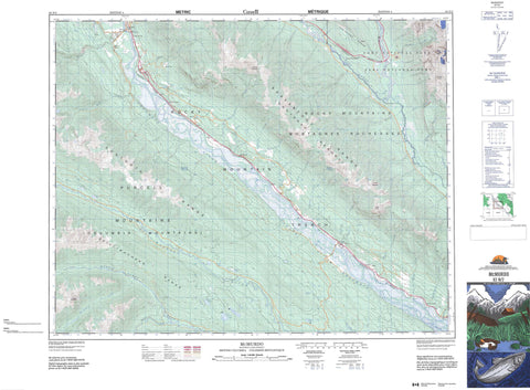
082N02 Mcmurdo Canada topo map, 1:50,000 scale
082N02 Mcmurdo NRCAN topographic map.
Includes UTM and GPS geographic coordinates (latitude and longitude). This 50k scale map is suitable for hiking, camping, and exploring, or you could frame it as a wall map.
Printed on-demand using high resolution, on heavy weight and acid free paper, or as an upgrade on a variety of synthetic materials.
Topos available on paper, Waterproof, Poly, or Tyvek. Usually shipping rolled, unless combined with other folded maps in one order.
- Product Number: NRCAN-082N02
- Parent Topo: TOPO-082N
- Map ID also known as: 082N02, 82N2, 82N02
- Unfolded Size: Approximately 26" high by 36" wide
- Weight (paper map): ca. 55 grams
- Map Type: POD NRCAN Topographic Map
- Map Scale: 1:50,000
- Geographical region: British Columbia, Canada
Neighboring Maps:
All neighboring Canadian topo maps are available for sale online at 1:50,000 scale.
Purchase the smaller scale map covering this area: Topo-082N
Spatial coverage:
Topo map sheet 082N02 Mcmurdo covers the following places:
- Back Channel - Baldy Channel - Hogranch Channel - Wapta Falls - Hanbury Glacier - Hobo Lake - Loon Lake - Nixon Lake - Redcliff Lake - Rocky Point Lake - Summit Lake - Three Island Lake - Whiskey Lake - Wilbur Lake - Beaverfoot Range - Butwell Peak - Cairn Mountain - Chancellor Peak - Columbia Mountains - Coral Mountain - Dogtooth Range - Kapristo Mountain - Kootenay Ranges - Montagnes Rocheuses - Ottertail Range - Purcell Mountains - Rocky Mountains - Spillimacheen Range - Tower Peak - Columbia-Shuswap Regional District - Regional District of Kootenay-Boundary - Parc national du Canada Yoho - Yoho National Park of Canada - Bayview Creek - Beard Creek - Beaverfoot River - Bicarbonate Creek - Birchlands Creek - Bobbie Burns Creek - Canyon Creek - Carbonate Creek - Clawson Creek - Columbia River - De Grazie Creek - Fleuve Columbia - Fraser Creek - Hobo Creek - Hobo Creek - Hogget Creek - Hogranch Creek - Hoodoo Creek - Horse Creek - Johnson Draw Creek - Kicking Horse River - Malachite Creek - Mallard Creek - Manitoba Creek - McBeath Creek - McKeeman Creek - Nelson Creek - Pagliaro Creek - Quinn Creek - Spillimacheen River - Steep Creek - Stony Creek - Tallis Creek - Tallon Creek - Twelve Mile Creek - Twin Creek - Vowell Creek - Wiedenman Creek - Carbonate - Castledale - Horse Creek - Leanchoil - McMurdo - Nicholson - Parson - Seeney - Hoodoo Valley - Rocky Mountain Trench


