
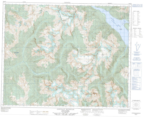
082M16 Argonaut Mountain Canada topo map, 1:50,000 scale
082M16 Argonaut Mountain NRCAN topographic map.
Includes UTM and GPS geographic coordinates (latitude and longitude). This 50k scale map is suitable for hiking, camping, and exploring, or you could frame it as a wall map.
Printed on-demand using high resolution, on heavy weight and acid free paper, or as an upgrade on a variety of synthetic materials.
Topos available on paper, Waterproof, Poly, or Tyvek. Usually shipping rolled, unless combined with other folded maps in one order.
- Product Number: NRCAN-082M16
- Parent Topo: TOPO-082M
- Map ID also known as: 082M16, 82M16
- Unfolded Size: Approximately 26" high by 36" wide
- Weight (paper map): ca. 55 grams
- Map Type: POD NRCAN Topographic Map
- Map Scale: 1:50,000
- Geographical region: British Columbia, Canada
Neighboring Maps:
All neighboring Canadian topo maps are available for sale online at 1:50,000 scale.
Purchase the smaller scale map covering this area: Topo-082M
Spatial coverage:
Topo map sheet 082M16 Argonaut Mountain covers the following places:
- Kinbasket Arm - Sullivan Arm - Windy Arm - Escarpment Glacier - French Glacier - Mist Glacier - Mud Glacier - Neptune Glacier - OK Glacier - Trident Glacier - Kinbasket Lake - Adamant Range - Argonaut Mountain - Big Bend Ranges - Columbia Mountains - Cronus Peak - Dolphin Peak - Escarpment Peak - Halia Mountain - Jason Peak - Kinbasket Mountain - Mermaid Mountain - Mount Chapman - Mount Hercules - Mount Medea - Mount Onderdonk - Neptune Peak - Northeast Mountain - Pluto Peak - Poseidon Peak - Rhea Peak - Rocky Mountains - Selkirk Mountains - Stegosaur Ridge - Townsends Ridge - Trident Mountain - Trident Peak - Windy Range - Yard-arm Ridge - Columbia-Shuswap Regional District - Argonaut Creek - Austerity Creek - Bigmouth Creek - Birch Creek - Bobcat Creek - Columbia River - Fleuve Columbia - French Creek - Goosegrass Creek - Kyanite Creek - Louis Lee Creek - Mica Creek - Norman Wood Creek - Trident Creek - Tsar Creek - Windy Creek - Yellow Creek - Columbia Reach - Anemone Pass - Rocky Mountain Trench


