
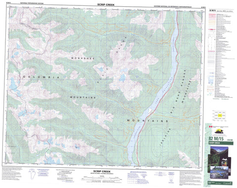
082M15 Scrip Creek Canada topo map, 1:50,000 scale
082M15 Scrip Creek NRCAN topographic map.
Includes UTM and GPS geographic coordinates (latitude and longitude). This 50k scale map is suitable for hiking, camping, and exploring, or you could frame it as a wall map.
Printed on-demand using high resolution, on heavy weight and acid free paper, or as an upgrade on a variety of synthetic materials.
Topos available on paper, Waterproof, Poly, or Tyvek. Usually shipping rolled, unless combined with other folded maps in one order.
- Product Number: NRCAN-082M15
- Parent Topo: TOPO-082M
- Map ID also known as: 082M15, 82M15
- Unfolded Size: Approximately 26" high by 36" wide
- Weight (paper map): ca. 55 grams
- Map Type: POD NRCAN Topographic Map
- Map Scale: 1:50,000
- Geographical region: British Columbia, Canada
Neighboring Maps:
All neighboring Canadian topo maps are available for sale online at 1:50,000 scale.
Purchase the smaller scale map covering this area: Topo-082M
Spatial coverage:
Topo map sheet 082M15 Scrip Creek covers the following places:
- Lake Revelstoke - Big Bend Ranges - Columbia Mountains - Gordon Horne Peak - Gordonhorne Peak - Monashee Mountains - Scrip Range - Selkirk Mountains - Seymour Range - Columbia-Shuswap Regional District - Gordon Rapid - Gordon Rapids - Bigmouth Creek - Birch Creek - Clear Creek - Columbia River - Fleuve Columbia - Horne Creek - Maloney Creek - Mammoth Creek - Mica Creek - Nicholls Creek - Oliver Creek - Pat Creek - Ruddock Creek - Scrip Creek - Twentyone Creek


