
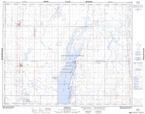
072P06 Imperial Canada topo map, 1:50,000 scale
072P06 Imperial NRCAN topographic map.
Includes UTM and GPS geographic coordinates (latitude and longitude). This 50k scale map is suitable for hiking, camping, and exploring, or you could frame it as a wall map.
Printed on-demand using high resolution, on heavy weight and acid free paper, or as an upgrade on a variety of synthetic materials.
Topos available on paper, Waterproof, Poly, or Tyvek. Usually shipping rolled, unless combined with other folded maps in one order.
- Product Number: NRCAN-072P06
- Parent Topo: TOPO-072P
- Map ID also known as: 072P06, 72P6, 72P06
- Unfolded Size: Approximately 26" high by 36" wide
- Weight (paper map): ca. 55 grams
- Map Type: POD NRCAN Topographic Map
- Map Scale: 1:50,000
- Geographical region: Saskatchewan, Canada
Neighboring Maps:
All neighboring Canadian topo maps are available for sale online at 1:50,000 scale.
Purchase the smaller scale map covering this area: Topo-072P
Spatial coverage:
Topo map sheet 072P06 Imperial covers the following places:
- Arlington Beach - Bird Island - Coney Island - Royal Island - Bulrush Lake - Colt Lake - Last Mountain Lake - Big Arm No. 251 - Last Mountain Valley No. 250 - Wood Creek No. 281 - Wreford No. 280 - Last Mountain Lake Bird Sanctuary - Last Mountain Lake National Wildlife Area - Last Mountain Lake Wildlife Management Unit - Last Mountain Regional Park - Refuge d'oiseaux de la Dernière-Montagne - Refuge d'oiseaux du lac de la Dernière-Montagne - Réserve nationale de faune de Stalwart - Réserve nationale de faune du Lac-Last-Mountain - Stalwart National Wildlife Area - Lanigan Creek - Lewis Creek - Saline Creek - Govan - Imperial - Hatfield - Imperial Beach - Watertown - Simpson


