
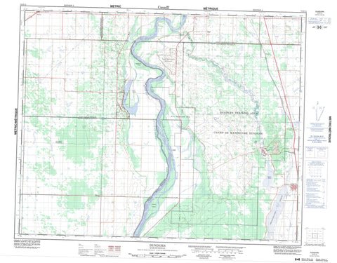
072O15 Dundurn Canada topo map, 1:50,000 scale
072O15 Dundurn NRCAN topographic map.
Includes UTM and GPS geographic coordinates (latitude and longitude). This 50k scale map is suitable for hiking, camping, and exploring, or you could frame it as a wall map.
Printed on-demand using high resolution, on heavy weight and acid free paper, or as an upgrade on a variety of synthetic materials.
Topos available on paper, Waterproof, Poly, or Tyvek. Usually shipping rolled, unless combined with other folded maps in one order.
- Product Number: NRCAN-072O15
- Parent Topo: TOPO-072O
- Map ID also known as: 072O15, 72O15
- Unfolded Size: Approximately 26" high by 36" wide
- Weight (paper map): ca. 55 grams
- Map Type: POD NRCAN Topographic Map
- Map Scale: 1:50,000
- Geographical region: Saskatchewan, Canada
Neighboring Maps:
All neighboring Canadian topo maps are available for sale online at 1:50,000 scale.
Purchase the smaller scale map covering this area: Topo-072O
Spatial coverage:
Topo map sheet 072O15 Dundurn covers the following places:
- Beaver Creek - White Cap 94 - Kennedy Islands - Macpherson Island - Young Island - Brightwater Lake - Indian Lake - Moon Lake - Pike Lake - Strehlow Pond - Swamp Lake - Wapisiu Lake - Corman Park No. 344 - Cory No. 344 - Dundurn No. 314 - Montrose No. 315 - Vanscoy No. 345 - Otapasoo Trails Recreation Site - Pike Lake Provincial Park - Brightwater Creek - Dundurn Creek - Rivière Saskatchewan Sud - South Saskatchewan River - Dundurn - Camp Dundurn - Dundurn Camp - Gledhow - Haultain - Pike Lake - Strehlow - Valley Park - Whitecap - Brightwater Marsh - Wapisiu Marsh - Vanscoy


