
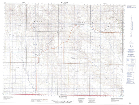
072G01 Canopus Canada topo map, 1:50,000 scale
072G01 Canopus NRCAN topographic map.
Includes UTM and GPS geographic coordinates (latitude and longitude). This 50k scale map is suitable for hiking, camping, and exploring, or you could frame it as a wall map.
Printed on-demand using high resolution, on heavy weight and acid free paper, or as an upgrade on a variety of synthetic materials.
Topos available on paper, Waterproof, Poly, or Tyvek. Usually shipping rolled, unless combined with other folded maps in one order.
- Product Number: NRCAN-072G01
- Parent Topo: TOPO-072G
- Map ID also known as: 072G01, 72G1, 72G01
- Unfolded Size: Approximately 26" high by 36" wide
- Weight (paper map): ca. 55 grams
- Map Type: POD NRCAN Topographic Map
- Map Scale: 1:50,000
- Geographical region: Saskatchewan, Canada
Neighboring Maps:
All neighboring Canadian topo maps are available for sale online at 1:50,000 scale.
Purchase the smaller scale map covering this area: Topo-072G
Spatial coverage:
Topo map sheet 072G01 Canopus covers the following places:
- Wood Mountain - Old Post No. 43 - Poplar Valley No. 12 - Bolster Creek - Border Creek - Borderland Creek - Coal Creek - Frontier Creek - Gilford Creek - Hay Meadow Creek - Horne Creek - Horse Thief Creek - Johnson Creek - Lost Child Creek - McIntyre Creek - Poplar River - Quantock Creek - Scaman Creek - Solverson Creek - Stewart Creek - West Poplar River - Borderland - Canopus - Killdeer - Lonesome Butte - Macworth - Quantock - Strathallen - West Poplar - Willowvale


