
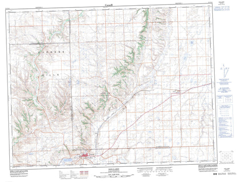
072F10 Dollard Canada topo map, 1:50,000 scale
072F10 Dollard NRCAN topographic map.
Includes UTM and GPS geographic coordinates (latitude and longitude). This 50k scale map is suitable for hiking, camping, and exploring, or you could frame it as a wall map.
Printed on-demand using high resolution, on heavy weight and acid free paper, or as an upgrade on a variety of synthetic materials.
Topos available on paper, Waterproof, Poly, or Tyvek. Usually shipping rolled, unless combined with other folded maps in one order.
- Product Number: NRCAN-072F10
- Parent Topo: TOPO-072F
- Map ID also known as: 072F10, 72F10
- Unfolded Size: Approximately 26" high by 36" wide
- Weight (paper map): ca. 55 grams
- Map Type: POD NRCAN Topographic Map
- Map Scale: 1:50,000
- Geographical region: Saskatchewan, Canada
Neighboring Maps:
All neighboring Canadian topo maps are available for sale online at 1:50,000 scale.
Purchase the smaller scale map covering this area: Topo-072F
Spatial coverage:
Topo map sheet 072F10 Dollard covers the following places:
- Dollard - Barrot Lake - Eastend Reservoir - Kirchoff Lake - Lawrence Lake - Leon Lake - Low Lake - Rose Lake - Anxiety Butte - Cypress Hills - Jones Peak - Jones Point - Ravenscrag Butte - Arlington No. 79 - Piapot No. 110 - White Valley No. 49 - Chimney Coulee Historic Site - Pine Cree Regional Park (Eastend Division) - Pine Cree Regional Park (Pine Cree Section) - Bone Creek - Conglomerate Creek - Frenchman River - Jones Creek - McNichol Creek - Rock Creek - Rose Creek - Swift Current Creek - Clinton Spring - Eastend - Klintonel - South Fork - Arnold Coulee - Axton Coulee - Baker Coulee - Bolingbroke Coulee - Bush Coulee - Charles Coulee - Chimney Coulee - Cranberry Coulee - Crawford Coulee - Dunlap Coulee - Eastend Coulee - Edward Coulee - Howard Coulee - Parker Coulee - Pine Coulee - Pollock Coulee - Stearns Coulee - Watson Coulee - Willis Coulee


