
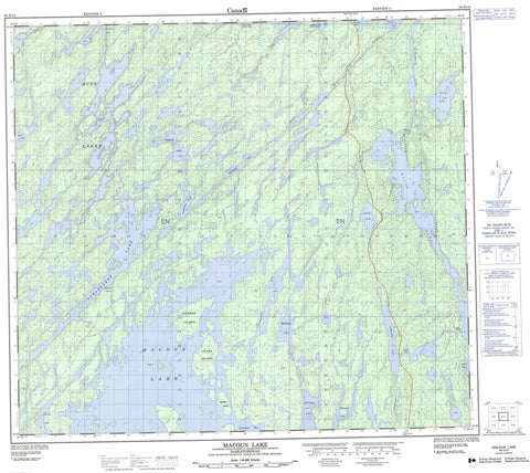
064D12 Macoun Lake Canada topo map, 1:50,000 scale
064D12 Macoun Lake NRCAN topographic map.
Includes UTM and GPS geographic coordinates (latitude and longitude). This 50k scale map is suitable for hiking, camping, and exploring, or you could frame it as a wall map.
Printed on-demand using high resolution, on heavy weight and acid free paper, or as an upgrade on a variety of synthetic materials.
Topos available on paper, Waterproof, Poly, or Tyvek. Usually shipping rolled, unless combined with other folded maps in one order.
- Product Number: NRCAN-064D12
- Parent Topo: TOPO-064D
- Map ID also known as: 064D12, 64D12
- Unfolded Size: Approximately 26" high by 36" wide
- Weight (paper map): ca. 55 grams
- Map Type: POD NRCAN Topographic Map
- Map Scale: 1:50,000
- Geographical region: Saskatchewan, Canada
Neighboring Maps:
All neighboring Canadian topo maps are available for sale online at 1:50,000 scale.
Purchase the smaller scale map covering this area: Topo-064D
Spatial coverage:
Topo map sheet 064D12 Macoun Lake covers the following places:
- Brennand Bay - Cairns Bay - Lightle Bay - Cameron Falls - Dickson Island - Leach Island - Sylvester Island - Buss Lakes - Coyle Lake - Cuelenaere Lake - David Lake - Davin Lake - Erickson Lake - Gocki Lake - Gunderson Lake - Henderson Lake - Kirby Lake - Macoun Lake - McKague Lake - McKeen Lake - McKnight Lake - Meili Lake - Ogilvie Lake - Pritchard Lake - Purdey Lake - Schaffer Lake - Thibeault Lake - Warren Lake - Yaholnitsky Lake - Fysh Rapids - Sawatzky Rapids - Schultz Rapids - McLennan Creek - Pink River - Ross River


