
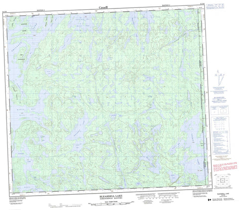
064D09 Bleasdell Lake Canada topo map, 1:50,000 scale
064D09 Bleasdell Lake NRCAN topographic map.
Includes UTM and GPS geographic coordinates (latitude and longitude). This 50k scale map is suitable for hiking, camping, and exploring, or you could frame it as a wall map.
Printed on-demand using high resolution, on heavy weight and acid free paper, or as an upgrade on a variety of synthetic materials.
Topos available on paper, Waterproof, Poly, or Tyvek. Usually shipping rolled, unless combined with other folded maps in one order.
- Product Number: NRCAN-064D09
- Parent Topo: TOPO-064D
- Map ID also known as: 064D09, 64D9, 64D09
- Unfolded Size: Approximately 26" high by 36" wide
- Weight (paper map): ca. 55 grams
- Map Type: POD NRCAN Topographic Map
- Map Scale: 1:50,000
- Geographical region: Manitoba, Canada
Neighboring Maps:
All neighboring Canadian topo maps are available for sale online at 1:50,000 scale.
Purchase the smaller scale map covering this area: Topo-064D
Spatial coverage:
Topo map sheet 064D09 Bleasdell Lake covers the following places:
- Asimwok Bay - Lemke Bay - Loon Bay - Lowdermilk Bay - Numakoos Bay - Stilborn Bay - Wapus Bay - Bell Peninsula - MacDonald Peninsula - Reynolds Peninsula - Fines Island - Fines Island - King Island - Shaw Island - Tatham Island - Upistutik Island - Bleasdell Lake - Bryant Lake - Chancellor Lake - Eichler Lake - Emperingham Lake - Eyaapo Lake - Garth Lake - Hillier Lake - Hind Lake - Laurie Lake - Laurie Lake - Lowdermilk Lake - Matwiy Lake - Moosooskaw Lake - Mortenson Lake - Noosas Lake - Osipoff Lake - Reindeer Lake - Rudolph Lake - Schwab Lake - Sutherby Lake - Upisk Lake - Wapus Lake - Wapusis Lake - Wetmore Lake - Wilkins Lake - Woodley Lake - Zaleschuk Lake - Mackie Rapids - Wapus River


