
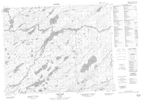
052O09 Tarp Lake Canada topo map, 1:50,000 scale
052O09 Tarp Lake NRCAN topographic map.
Includes UTM and GPS geographic coordinates (latitude and longitude). This 50k scale map is suitable for hiking, camping, and exploring, or you could frame it as a wall map.
Printed on-demand using high resolution, on heavy weight and acid free paper, or as an upgrade on a variety of synthetic materials.
Topos available on paper, Waterproof, Poly, or Tyvek. Usually shipping rolled, unless combined with other folded maps in one order.
- Product Number: NRCAN-052O09
- Parent Topo: TOPO-052O
- Map ID also known as: 052O09, 52O9, 52O09
- Unfolded Size: Approximately 26" high by 36" wide
- Weight (paper map): ca. 55 grams
- Map Type: POD NRCAN Topographic Map
- Map Scale: 1:50,000
- Geographical region: Ontario, Canada
Neighboring Maps:
All neighboring Canadian topo maps are available for sale online at 1:50,000 scale.
Purchase the smaller scale map covering this area: Topo-052O
Spatial coverage:
Topo map sheet 052O09 Tarp Lake covers the following places:
- Kishkap Falls - Connell - McCullagh - Ponsford - Atik Lake - Bow Lake - Engler Lake - Froats Lake - Kibler Lake - Musser Lakes - Otoskwin Lake - Ponsford Lake - Shinagmabin Lake - Tarp Lake - Trebell Lake - Wyvill Lake - Pipestone River Provincial Park - Deepwater Rapids - Kukuku Rapids - Long Current Rapids - Shoal Rock Rapids - Steep Rock Rapids - Atik Creek - Bow River - Dobie River - Kawinogans River - Otoskwin River - Ponsford Creek - Shinagmabin Creek - Tarp Creek - Pickle Crow


