
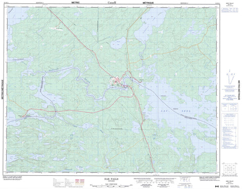
052K11 Ear Falls Canada topo map, 1:50,000 scale
052K11 Ear Falls NRCAN topographic map.
Includes UTM and GPS geographic coordinates (latitude and longitude). This 50k scale map is suitable for hiking, camping, and exploring, or you could frame it as a wall map.
Printed on-demand using high resolution, on heavy weight and acid free paper, or as an upgrade on a variety of synthetic materials.
Topos available on paper, Waterproof, Poly, or Tyvek. Usually shipping rolled, unless combined with other folded maps in one order.
- Product Number: NRCAN-052K11
- Parent Topo: TOPO-052K
- Map ID also known as: 052K11, 52K11
- Unfolded Size: Approximately 26" high by 36" wide
- Weight (paper map): ca. 55 grams
- Map Type: POD NRCAN Topographic Map
- Map Scale: 1:50,000
- Geographical region: Ontario, Canada
Neighboring Maps:
All neighboring Canadian topo maps are available for sale online at 1:50,000 scale.
Purchase the smaller scale map covering this area: Topo-052K
Spatial coverage:
Topo map sheet 052K11 Ear Falls covers the following places:
- Goose Bay - Sawmill Bay - Lunker Point - Steamboat Narrows - Ear Falls - Lower Manitou Falls - Manitou Falls - Upper Manitou Falls - Goose Islands - Barnston Lake - Brownbear Lake - Camping Lake - Cramp Lake - Cristene Lake - Detector Lake - Goose Lake - Gould Lake - Howard Lake - Lac Seul - Minnow Lake - Nine Mile Lake - Pakwash Lake - Pakwash Lakes - Rice Lake - Wenasaga Lake - Zizania Lake - Ear Falls - Anishinabi River - Brownbear Creek - Camp Nine Creek - Cedar River - Chukuni River - Cramp Creek - English River - Fatty Creek - Gould Creek - Lowfish River - Sandy Creek - Wenasaga River - Ear Falls - Goldpines - Lac Seul - Manitou Falls


