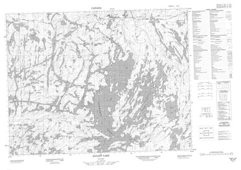
052J02 Savant Lake Canada topo map, 1:50,000 scale
052J02 Savant Lake NRCAN topographic map.
Includes UTM and GPS geographic coordinates (latitude and longitude). This 50k scale map is suitable for hiking, camping, and exploring, or you could frame it as a wall map.
Printed on-demand using high resolution, on heavy weight and acid free paper, or as an upgrade on a variety of synthetic materials.
Topos available on paper, Waterproof, Poly, or Tyvek. Usually shipping rolled, unless combined with other folded maps in one order.
- Product Number: NRCAN-052J02
- Parent Topo: TOPO-052J
- Map ID also known as: 052J02, 52J2, 52J02
- Unfolded Size: Approximately 26" high by 36" wide
- Weight (paper map): ca. 55 grams
- Map Type: POD NRCAN Topographic Map
- Map Scale: 1:50,000
- Geographical region: Ontario, Canada
Neighboring Maps:
All neighboring Canadian topo maps are available for sale online at 1:50,000 scale.
Purchase the smaller scale map covering this area: Topo-052J
Spatial coverage:
Topo map sheet 052J02 Savant Lake covers the following places:
- Belmore Bay - Black Bay - Cobb Bay - Countryman's Bay - East Bay - Horizontal Bay - Jones Bay - King Bay - Marie's Bay - Nipigon Bay - North Arm - Northeast Arm - Shore's Bay - St. Anthony Bay - Green Point - Hotel Point - The Horn - Trapper's Point - Canoe Channel - Deadhorse Narrows - Droopy Narrows - Steamboat Channel - Symmes Narrows - White Falls - Boucher - Chevrier - Thunder Bay - St Anthony Dam - Burnt Island - Coveney Island - Fire Ranger Island - Johnson Island - Morgan Island - Rainbow Island - Second Island - Back Lake - Barnard Lake - Beckington Lake - Belanger Lake - Canoe Lake - Chivelston Lake - Clear Lake - Clevis Lake - Couture Lake - Coveney Lake - Dan's Lake - Davies Lake - Die Lake - Dizzy Lake - Eady Lake - Empress Lake - Fly Lake - Fourbay Lake - Fowler Lake - Fraser Lake - Grup Lake - Jessie Lake - Jumping Lake - Loch Gordon - London Lake - Magee Lake - McEdwards Lake - Michell Lake - Miners Lake - Ouilette Lake - Pumphouse Lake - Pup Lake - Queens Lake - Rainbow Lake - Richan Lake - Ringham Lake - Rome Lake - Saunders Lake - Six Mile Lake - Sixmile Lake - South Lake - Squaw Lake - Stringbean Lake - Sturgeon Lake - Threebay Lake - Trap Lake - Vanessa Lake - Vista Lake - Wellington Lake - Wolf Lake - Wrench Lake - Yon Lake - Zen Lake - Barnard Creek - Coveney Creek - Quest Creek - Six Mile Creek - Sturgeon River - Trout Creek - Vista Creek - Fowler - Savant Lake - St. Anthony Mine - Staunton - Trapper's Landing


