
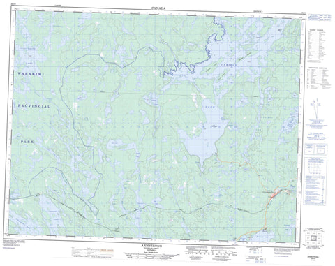
052I06 Armstrong Canada topo map, 1:50,000 scale
052I06 Armstrong NRCAN topographic map.
Includes UTM and GPS geographic coordinates (latitude and longitude). This 50k scale map is suitable for hiking, camping, and exploring, or you could frame it as a wall map.
Printed on-demand using high resolution, on heavy weight and acid free paper, or as an upgrade on a variety of synthetic materials.
Topos available on paper, Waterproof, Poly, or Tyvek. Usually shipping rolled, unless combined with other folded maps in one order.
- Product Number: NRCAN-052I06
- Parent Topo: TOPO-052I
- Map ID also known as: 052I06, 52I6, 52I06
- Unfolded Size: Approximately 26" high by 36" wide
- Weight (paper map): ca. 55 grams
- Map Type: POD NRCAN Topographic Map
- Map Scale: 1:50,000
- Geographical region: Ontario, Canada
Neighboring Maps:
All neighboring Canadian topo maps are available for sale online at 1:50,000 scale.
Purchase the smaller scale map covering this area: Topo-052I
Spatial coverage:
Topo map sheet 052I06 Armstrong covers the following places:
- Alphonse Bay - Garden Bay - Outlet Bay - Outlet Bay - Scow Bay - Fred's Point - Réserve indienne Whitesand - Whitesand - Beaver Island - Cove Island - Green Island - Saturday Island - The Five Islands - Armstrong Lake - Badwater Lake - Bath Lake - Big Lake - Black Lake - Canon Lake - Caribou Lake - Chief Lake - Clearwater Lake - Collins Lake - Doe Lake - Fawn Lake - Frog Lake - Gibson Lake - Gnome Lake - Haig Lake - Harvey Lake - Lindholm Lake - Little Caribou Lake - Mackenzie Lake - Mattice Lake - McKenzie Lake - Narrows Lake - Octopus Lake - Red Granite Lake - Rocky Island Lake - Secord Lake - Shawanabis Lake - Smoothrock Lake - Spring Lake - Tamarack Lake - Tower Lake - Track Lake - Trail Lake - Tunnel Lake - Upper Badwater Lake - Upper Secord Lake - Wabakimi Provincial Park - Boiling Sand Rapids - Badwater Creek - Boiling Sand River - Burn Creek - Caribou River - Morris Creek - Rocky Island Creek - Secord Creek - Vale Creek - Wabinosh River - Prairie Portage - Armstrong - Armstrong Station - Collins - Onaping - Pascopee - Armstrong Station


