
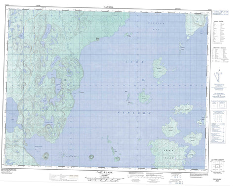
052I02 Castle Lake Canada topo map, 1:50,000 scale
052I02 Castle Lake NRCAN topographic map.
Includes UTM and GPS geographic coordinates (latitude and longitude). This 50k scale map is suitable for hiking, camping, and exploring, or you could frame it as a wall map.
Printed on-demand using high resolution, on heavy weight and acid free paper, or as an upgrade on a variety of synthetic materials.
Topos available on paper, Waterproof, Poly, or Tyvek. Usually shipping rolled, unless combined with other folded maps in one order.
- Product Number: NRCAN-052I02
- Parent Topo: TOPO-052I
- Map ID also known as: 052I02, 52I2, 52I02
- Unfolded Size: Approximately 26" high by 36" wide
- Weight (paper map): ca. 55 grams
- Map Type: POD NRCAN Topographic Map
- Map Scale: 1:50,000
- Geographical region: Ontario, Canada
Neighboring Maps:
All neighboring Canadian topo maps are available for sale online at 1:50,000 scale.
Purchase the smaller scale map covering this area: Topo-052I
Spatial coverage:
Topo map sheet 052I02 Castle Lake covers the following places:
- Castle Bay - North Bay - Wabinosh Bay - Windigo Bay - Meeting Point - Blind Channel - Bare Island - Barlow Island - Barn Islands - Billings Island - Britannia Islands - Castle Island - Cat Tail Islands - Cat-tail Islands - Ells Island - Geikie Island - Hoffmann Island - Hunt Island - Inner Barn Island - Murray Island - Ord Island - Outer Barn Island - Snake Island - Vennor Island - Whiteaves Island - Windigo Islands - Beacon Lake - Boswell Lake - Camel Read Lake - Castle Lake - Clamp Lake - Inspiration Lake - Lac Nipigon - Lake Nipigon - Millercamp Lake - Morgan Lake - Punt Lakes - Snowshoe Lake - Vallee Lake - Wabinosh Lake - Walkover Lake - Mount St. John - Outer Barn Island Wilderness Area - Windigo Bay Provincial Nature Reserve - Castle Creek - Hoodoo Creek - Kenna Creek - Wabinosh River - Whitesand River - Ken's Rock


