
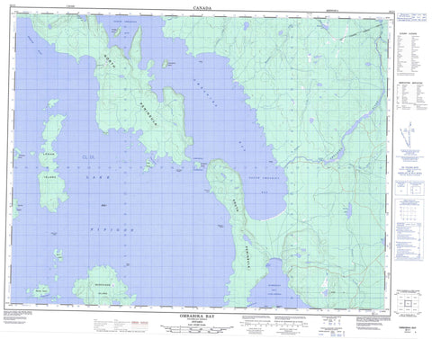
052I01 Ombabika Bay Canada topo map, 1:50,000 scale
052I01 Ombabika Bay NRCAN topographic map.
Includes UTM and GPS geographic coordinates (latitude and longitude). This 50k scale map is suitable for hiking, camping, and exploring, or you could frame it as a wall map.
Printed on-demand using high resolution, on heavy weight and acid free paper, or as an upgrade on a variety of synthetic materials.
Topos available on paper, Waterproof, Poly, or Tyvek. Usually shipping rolled, unless combined with other folded maps in one order.
- Product Number: NRCAN-052I01
- Parent Topo: TOPO-052I
- Map ID also known as: 052I01, 52I1, 52I01
- Unfolded Size: Approximately 26" high by 36" wide
- Weight (paper map): ca. 55 grams
- Map Type: POD NRCAN Topographic Map
- Map Scale: 1:50,000
- Geographical region: Ontario, Canada
Neighboring Maps:
All neighboring Canadian topo maps are available for sale online at 1:50,000 scale.
Purchase the smaller scale map covering this area: Topo-052I
Spatial coverage:
Topo map sheet 052I01 Ombabika Bay covers the following places:
- Humboldt Bay - Moran Harbour - North Bay - North Ombabika Bay - Ombabika Bay - Peninsula Harbour - Ramsay Harbour - South Ombabika Bay - Diamond Point - North Bay Point - North Peninsula - South Peninsula - Ombabika Narrows - Ombabika Dam - Burnt Island - Duke Island - Gull Rock Island - Hitchcock Island - Hoffmann Island - Knob Island - Leo Island - Little Burnt Island - Locomotive Island - Logan Island - Murchison Island - Ombabika Island - Phillip Island - Portage Island - Ramsay Island - Range Island - Vennor Island - Clod Lake - Davidson Lake - Lac Nipigon - Lake Nipigon - Minataree Lake - Rout Lake - Ombabika Rapids - Beeva Creek - Bowser Creek - Duke Channel - Hogan Creek - Lamaune Creek - Marten Creek - Minataree Creek - Ombabika River - Diamond Shoals - Ray's Reef - Scarf Rock - Minataree


