
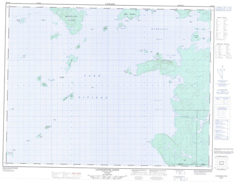
052H16 Livingstone Point Canada topo map, 1:50,000 scale
052H16 Livingstone Point NRCAN topographic map.
Includes UTM and GPS geographic coordinates (latitude and longitude). This 50k scale map is suitable for hiking, camping, and exploring, or you could frame it as a wall map.
Printed on-demand using high resolution, on heavy weight and acid free paper, or as an upgrade on a variety of synthetic materials.
Topos available on paper, Waterproof, Poly, or Tyvek. Usually shipping rolled, unless combined with other folded maps in one order.
- Product Number: NRCAN-052H16
- Parent Topo: TOPO-052H
- Map ID also known as: 052H16, 52H16
- Unfolded Size: Approximately 26" high by 36" wide
- Weight (paper map): ca. 55 grams
- Map Type: POD NRCAN Topographic Map
- Map Scale: 1:50,000
- Geographical region: Ontario, Canada
Neighboring Maps:
All neighboring Canadian topo maps are available for sale online at 1:50,000 scale.
Purchase the smaller scale map covering this area: Topo-052H
Spatial coverage:
Topo map sheet 052H16 Livingstone Point covers the following places:
- Bean Bay - Cap Cove - East Bay - Fire Ranger Bay - Humboldt Bay - Peninsula Harbour - Stone Bay - Vint Bay - Weber's Harbour - Crocker Point - Gravel Point - Graveyard Point - Livingstone Point - Magnet Point - Mungo Park Point - Smoothrock Point - South Peninsula - Garek's Gap - Barbara - Dorothea - Meader - Sandra - Anderson Islands - Bison Island - Cackleberry Island - Deer Island - Eagle Egg Island - Francis Island - Gillespie Island - Gorda Island - Gull Island - Hall Island - Harbour Island - Harry Island - Hitchcock Island - Knob Island - Lyell Island - McIvor Islands - McKellar Island - Morock Island - Murchison Island - Passage Isle - Porcupine Island - Rambler Islands - Ranger Island - Rodger Island - Round Island - Russell Island - Selwyn Island - Sister Islands - Tichnor Islands - Trout Island - Wigwam Island - Woldridge Island - Lac Nipigon - Lake Nipigon - Little Lake - North Wind Lake - Iron Range Bluff - Pyramid Hill - Beardmore - Nakina - Livingstone Point Provincial Nature Reserve - Bean Creek - Hogan Creek - Littlelake River - North Wind River - Onaman River - Stewart Creek - Tyrol River - Bateau Rock - Hardy Shoals - Margaret Reef - Tichnor Shoal - Greenstone


