
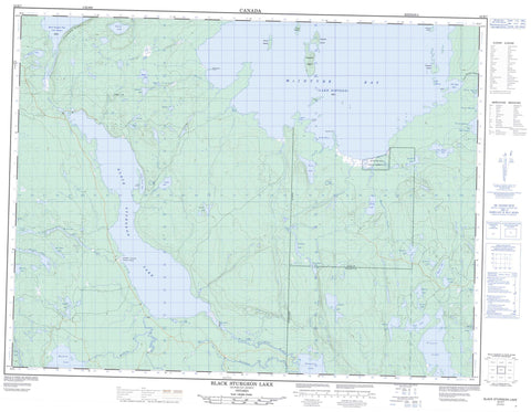
052H07 Black Sturgeon Lake Canada topo map, 1:50,000 scale
052H07 Black Sturgeon Lake NRCAN topographic map.
Includes UTM and GPS geographic coordinates (latitude and longitude). This 50k scale map is suitable for hiking, camping, and exploring, or you could frame it as a wall map.
Printed on-demand using high resolution, on heavy weight and acid free paper, or as an upgrade on a variety of synthetic materials.
Topos available on paper, Waterproof, Poly, or Tyvek. Usually shipping rolled, unless combined with other folded maps in one order.
- Product Number: NRCAN-052H07
- Parent Topo: TOPO-052H
- Map ID also known as: 052H07, 52H7, 52H07
- Unfolded Size: Approximately 26" high by 36" wide
- Weight (paper map): ca. 55 grams
- Map Type: POD NRCAN Topographic Map
- Map Scale: 1:50,000
- Geographical region: Ontario, Canada
Neighboring Maps:
All neighboring Canadian topo maps are available for sale online at 1:50,000 scale.
Purchase the smaller scale map covering this area: Topo-052H
Spatial coverage:
Topo map sheet 052H07 Black Sturgeon Lake covers the following places:
- Black Sturgeon Bay - Jess' Harbour - Krug Bay - Long Point Bay - McIntyre Bay - Portage Bay - Robson Bay - Three Mount Bay - Twin Rivers - Breakwater Point - Long Point - Mooney Point - Robson Point - Tchiatang Bluff - Graydon - Innes - Thunder Bay - Asinab Island - Birch Island - Elgie Island - Faribault Island - Fletcher Island - Glover Island - Piwabik Island - Tommy's Island - Agate Lake - Alwyn Lake - Arrowhead Lake - Beaver Pond - Black Sturgeon Lake - Boomer Lake - Camper Lake - Canister Lake - Cedric Lake - Emerald Lake - Ferguson Lake - Frazer Lake - Gadsby Lake - Gavin Lake - Gelapa Lake - Graydon Lake - Ground Lake - Jam Lake - Jim Lake - Krug Lake - Lac Nipigon - Lake Nipigon - Linton Lake - McCann Lake - Meadow Lake - Metivier Lake - Mikinak Lake - Muskrat Lake - Nonwatin Lake - Olive Lake - Pavely Lake - Presland Lake - Pucker Lake - Ripple Lake - Roland Lake - Royle Lake - Sea Green Lake - Shaver Lake - Sing Lake - Swampy Lake - Three Mount Lake - Tweed Lake - Udell Lake - Wigwam Lake - Yule Lake - Black Sturgeon River Provincial Park - Split Rapids - Black Sturgeon River - Camper Creek - Canister Creek - Circle Creek - Emerald Creek - Ferguson Creek - Jam Creek - Krug Creek - McCann Creek - Muskrat River - Nonwatin River - Owl Creek - Spruce River - Three Mountain Portage - Joe's Rock


