
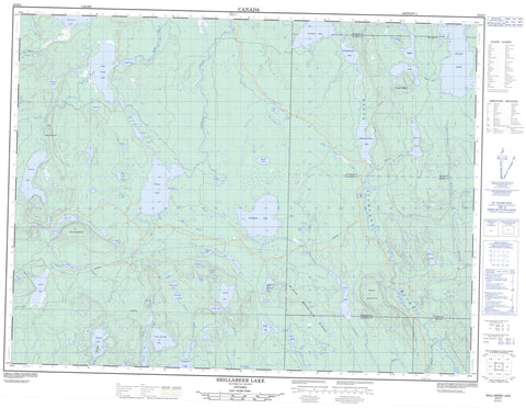
052H02 Shillabeer Lake Canada topo map, 1:50,000 scale
052H02 Shillabeer Lake NRCAN topographic map.
Includes UTM and GPS geographic coordinates (latitude and longitude). This 50k scale map is suitable for hiking, camping, and exploring, or you could frame it as a wall map.
Printed on-demand using high resolution, on heavy weight and acid free paper, or as an upgrade on a variety of synthetic materials.
Topos available on paper, Waterproof, Poly, or Tyvek. Usually shipping rolled, unless combined with other folded maps in one order.
- Product Number: NRCAN-052H02
- Parent Topo: TOPO-052H
- Map ID also known as: 052H02, 52H2, 52H02
- Unfolded Size: Approximately 26" high by 36" wide
- Weight (paper map): ca. 55 grams
- Map Type: POD NRCAN Topographic Map
- Map Scale: 1:50,000
- Geographical region: Ontario, Canada
Neighboring Maps:
All neighboring Canadian topo maps are available for sale online at 1:50,000 scale.
Purchase the smaller scale map covering this area: Topo-052H
Spatial coverage:
Topo map sheet 052H02 Shillabeer Lake covers the following places:
- Muskeg Bay - South Bay - Adamson - Church - Cockeram - Graydon - Hele - McIvor - McMaster - McComb Island - Abigogami Lake - Albert Lake - Anders Lake - Arnott Lake - Beatty Lake - Beaverhide Lake - Black Mountain Lake - Caro Lake - Church Lake - Cliff Lake - Disraeli Lake - Eileen Lake - Elm Lake - Embargo Lake - Enterprise Lake - Eskwanonwatin Lake - Evelyn Lake - Fog Lake - Forbes Lake - Forget Lake - Frazer Lake - Hayes Lake - Henderson Lake - Holness Lake - Jaw Lake - Laroche Lake - Leckie Lake - Little Sturge Lake - Lower Narrow Lake - Lynch Lake - Magee Lake - Mirror Lake - Mona Lake - Moon Lake - Moraine Lake - Mound Lake - Muskrat Lake - Nonwatin Lake - Nonwatinose Lake - Point Lake - Poplar Lake - Pringle Lake - Schmoo Lake - Scooper Lake - Seagull Lake - Shillabeer Lake - Shook Lake - Sigh Lake - Sirecho Lake - Slop Lake - Sprout Lake - Sturge Lake - True Lake - Twerp Lake - Twit Lake - Upper Narrow Lake - Veronica Lake - Zoot Lake - Black Mountain Ridge - Fox Mountains - Mount Magee - Wolf Mountain - Wolf Mountains - Albert Lake Mesa Provincial Nature Reserve - Black Sturgeon River Provincial Park - Shook Lake Conservation Reserve - Nonwatin Rapids - Amos Creek - Arnott Creek - Black Sturgeon River - Disraeli Creek - Henderson Creek - Holness Creek - John Creek - Larson Creek - Leckie Creek - Little Muskrat River - Lynch Creek - Magee Creek - McGaw Creek - Mona Creek - Moon Creek - Mound Creek - Nonwatin River - Scooper Creek - Seagull Creek - Sprout Creek - Spruce River - Twit Creek - Wolfpup Creek - Zoot Creek - Eagle Mountain


