
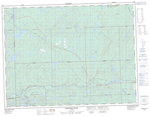
052G02 Firesteel River Canada topo map, 1:50,000 scale
052G02 Firesteel River NRCAN topographic map.
Includes UTM and GPS geographic coordinates (latitude and longitude). This 50k scale map is suitable for hiking, camping, and exploring, or you could frame it as a wall map.
Printed on-demand using high resolution, on heavy weight and acid free paper, or as an upgrade on a variety of synthetic materials.
Topos available on paper, Waterproof, Poly, or Tyvek. Usually shipping rolled, unless combined with other folded maps in one order.
- Product Number: NRCAN-052G02
- Parent Topo: TOPO-052G
- Map ID also known as: 052G02, 52G2, 52G02
- Unfolded Size: Approximately 26" high by 36" wide
- Weight (paper map): ca. 55 grams
- Map Type: POD NRCAN Topographic Map
- Map Scale: 1:50,000
- Geographical region: Ontario, Canada
Neighboring Maps:
All neighboring Canadian topo maps are available for sale online at 1:50,000 scale.
Purchase the smaller scale map covering this area: Topo-052G
Spatial coverage:
Topo map sheet 052G02 Firesteel River covers the following places:
- Colliver - Corman - Hanniwell - Inwood - Meinzinger - Patrick - Pyramid - Rainy River - Stedman - Trewartha - Upsala - Réserve indienne Seine River 22A2 - Seine River 22A2 - Seine River Indian Reserve 22A2 - Antler Lake - Barth Lake - Graham Lake - Hawk Lake - Hay Lake - Jewel Lake - Knuckle Lake - Little Chill Lake - Little Trewartha Lake - Longross Lake - Lower Squirrel Lake - Mere Lake - Mosher Lake - Pyramid Lake - Rabbitswim Lake - Sheba Lake - Stedman Lake - Stretch Lake - Tea Lake - Tomlinson Lake - Trewartha Lake - Umber Lake - Upper Squirrel Lake - Trewartha Creek Conservation Reserve - Antler Creek - Antler Creek - Beaver River - Brush Creek - Chill Creek - East Firesteel River - English River - Firesteel River - Hay River - Inwood Creek - Little Trewartha Creek - North Firesteel River - Redfox Creek - Rosscairn Creek - Rush Creek - Scotch River - Seine River - Sheba Creek - Squirrel Creek - Stedman Creek - Tea Creek - Trewartha Creek - Brush Portage - Snake Portage - Squirrel Portage - English River - English River - Graham - Niblock


