
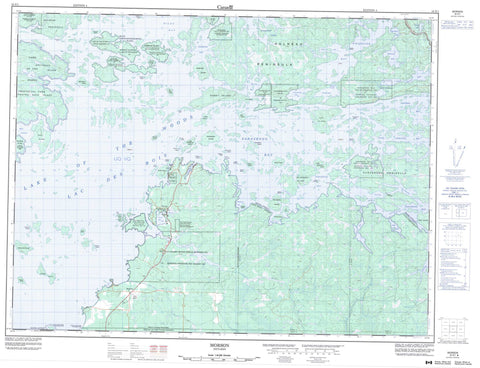
052E01 Morson Canada topo map, 1:50,000 scale
052E01 Morson NRCAN topographic map.
Includes UTM and GPS geographic coordinates (latitude and longitude). This 50k scale map is suitable for hiking, camping, and exploring, or you could frame it as a wall map.
Printed on-demand using high resolution, on heavy weight and acid free paper, or as an upgrade on a variety of synthetic materials.
Topos available on paper, Waterproof, Poly, or Tyvek. Usually shipping rolled, unless combined with other folded maps in one order.
- Product Number: NRCAN-052E01
- Parent Topo: TOPO-052E
- Map ID also known as: 052E01, 52E1, 52E01
- Unfolded Size: Approximately 26" high by 36" wide
- Weight (paper map): ca. 55 grams
- Map Type: POD NRCAN Topographic Map
- Map Scale: 1:50,000
- Geographical region: Ontario, Canada
Neighboring Maps:
All neighboring Canadian topo maps are available for sale online at 1:50,000 scale.
Purchase the smaller scale map covering this area: Topo-052E
Spatial coverage:
Topo map sheet 052E01 Morson covers the following places:
- Alfred Inlet - Atikaminike Bay - Big Camp Bay - Burrow Bay - Deer Bay - Devils Bay - Gohere Bay - Hanson Bay - Hay Bay - Jackpine Bay - Matheson Bay - Miles Bay - Morton Bay - Obabikon Bay - Purdy Bay - Sabaskong Bay - Sand Bay - Splitrock Bay - Stevens Bay - Stony Portage Bay - Swens Bay - Taylor Bay - Whitefish Bay - Aulneau Peninsula - Last Point - Mamiou Point - Point Brûlé - Pork Point - Rabbit Point - Sabaskong Peninsula - Splitrock Point - Stairway Point - Big Marsh Narrows - Fish Narrows - Painted Rock Channel - Splitrock Narrows - Sunset Chain Channel - Turtle Portage Channel - Croome - Dewart - Mathieu - McCrosson - Morson - Phillips - Rainy River - Rowe - Tovell - Big Grassy River 35G - Big Grassy River Indian Reserve 35G - Big Island Mainland 93 - Big Island Mainland Indian Reserve 93 - Lake of the Woods 35J - Lake of the Woods Indian Reserve 35J - Naongashing Indian Reserve 31A - Naongashing Indian Reserve 35A - Obabikong Indian Reserve 35B - Réserve indienne Big Grassy River 35G - Réserve indienne Big Island Mainland 93 - Réserve indienne Lake of the Woods 35J - Réserve indienne Naongashing 31A - Réserve indienne Naongashing 35A - Réserve indienne Obabikong 35B - Réserve indienne Sabaskong Bay 32C - Réserve indienne Sabaskong Bay 35C - Réserve indienne Sabaskong Bay 35F - Réserve indienne Sabaskong Bay 35H - Réserve indienne Saug-A-Gaw-Sing 1 - Sabaskong Bay 32C - Sabaskong Bay 35C - Sabaskong Bay 35F - Sabaskong Bay 35H - Sabaskong Bay Indian Reserve 32C - Sabaskong Bay Indian Reserve 35C - Sabaskong Bay Indian Reserve 35F - Sabaskong Bay Indian Reserve 35H - Saug-A-Gaw-Sing 1 - Saug-A-Gaw-Sing Indian Reserve 1 - Basil Island - Big Black Island - Big Marsh Island - Black Island - Blueberry Island - Bluffy Island - Boomstick Island - Brûlé Island - Buckeye Island - Buff Island - Burnt Island - Cedar Island - Comegan Island - Dawson Island - Farnsworth Island - Fishery Island - Fox Island - Garden Island - Gooseneck Island - Greens Island - Harbour Island - Hay Island - Horseshoe Island - King Island - Knoche Island - Little Blueberry Island - Little Raspberry Island - Lowes Island - Maggie Island - Manitou Island - Miles (Sanguishomiouming) Island - Mineral Island - Mitchell Island - Painted Rock Island - Pentney Island - Poplar Island - Rabbit Island - Raspberry Island - Round Island - Rowell Island - Sanguishii-aagaamiing - Sanguishii-aagaamiising - Splitrock Island - Squaw Island - Tar Vat Island - Three Pine Island - Village Island - Waldron Island - Wisakode Island - Wolf Island - Eleanor Lake - Girard Lake - Kahmitiwajewunk Lake - Kawakamik Lake - Lac des Bois - Lake of the Woods - Obabikon Lake - Robinson Lake - South Narrow Lake - Turtle Lake - Lake of the Woods - McCrosson and Tovell - McGeorge & Willingdon - Morley - Morson - Sioux Narrows - Sioux Narrows Nestor Falls - Sioux Narrows-Nestor Falls - Lake of the Woods Provincial Park - Miles Bay Conservation Reserve - Big Grassy River - Grassy River - Splitrock River - Spruce Creek - Elm Portage - Sand Portage - Turtle Portage - Mather Reef - Minahico - Morson


