
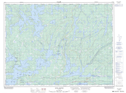
052C15 Mine Centre Canada topo map, 1:50,000 scale
052C15 Mine Centre NRCAN topographic map.
Includes UTM and GPS geographic coordinates (latitude and longitude). This 50k scale map is suitable for hiking, camping, and exploring, or you could frame it as a wall map.
Printed on-demand using high resolution, on heavy weight and acid free paper, or as an upgrade on a variety of synthetic materials.
Topos available on paper, Waterproof, Poly, or Tyvek. Usually shipping rolled, unless combined with other folded maps in one order.
- Product Number: NRCAN-052C15
- Parent Topo: TOPO-052C
- Map ID also known as: 052C15, 52C15
- Unfolded Size: Approximately 26" high by 36" wide
- Weight (paper map): ca. 55 grams
- Map Type: POD NRCAN Topographic Map
- Map Scale: 1:50,000
- Geographical region: Ontario, Canada
Neighboring Maps:
All neighboring Canadian topo maps are available for sale online at 1:50,000 scale.
Purchase the smaller scale map covering this area: Topo-052C
Spatial coverage:
Topo map sheet 052C15 Mine Centre covers the following places:
- Crowrock Bay - Crowrock Inlet - Headlight Bay - Indian Bay - Mariah Bay - Muskee Bay - North Marsh - Northeast Bay - Northwest Bay - Olive Bay - Porter Inlet - Redgut Bay - South Marsh - Spawn Inlet - Clubhouse Point - The Headlight - Cliff Narrows - Crooked Narrows - Grassy Narrows - Parry Strait - Pine Narrows - Red Pine Narrows - Sand Island Narrows - Twin Narrows - Otter Falls - Otter Falls - Sand Falls - Sand Island Falls - Sawbill Falls - Farrington - Rainy River - Rainy Lake 26B - Rainy Lake 26C - Rainy Lake Indian Reserve 26A - Rainy Lake Indian Reserve 26B - Rainy Lake Indian Reserve 26C - Réserve indienne Rainy Lake 26A - Réserve indienne Rainy Lake 26B - Réserve indienne Rainy Lake 26C - Blueberry Island - Deer Island - Gull Islands - Hamel's Island - Indian Island - Raspberry Island - Smiths Island - Williams Island - Windy Island - Bad Vermilion Lake - Big Sawbill Lake - Bluebeard Lake - Cherry Lake - Cornell Lake - Crackshot Lake - Cruso Lake - Doman Lake - Eldridge Lake - Falloon Lake - Gallo Lake - Heron Lake - Hoard Lake - Hollands Lake - Lac à la Pluie - Law Lake - Little Ottertail Lake - Little Sawbill Lake - Little Turtle Lake - Lowe Lake - Lowry Lake - Makomesut Lake - Marsh Lake - Marston Lake - McVey Lake - Mong Lake - O'Connell Lake - Otter Lake - Ottertail Lake - Otukamamoan Lake - Patton Lake - Peninsula Lake - Pilkey Lake - Pope Lake - Rainy Lake - Readman Lake - Ryckman Lake - Tesup Lake - Tibbetts Lake - Tower Lake - Tyne Lake - Whitewater Lake - Winkle Lake - Turtle River Provincial Park - Turtle River-White Otter Lake Provincial Park - Manitou Rapids - Otter Rapids - Big Turtle River - Bluebeard Creek - Cherry River - Christy Creek - Eldridge Creek - Entwine River - Farrington Creek - Heron River - Kaopskikamak River - Little Ottertail River - Little Turtle River - Muskeg Creek - Ottertail River - Tesup Creek - Trout River - Turtle River - Devils Elbow - Sand Island Falls Portage - Windfall Portage - Farrington - Mine Centre - Olive - Turtle


