
052C14 Mainville Lake Canada topo map, 1:50,000 scale
052C14 Mainville Lake NRCAN topographic map.
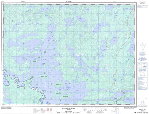
Includes UTM and GPS geographic coordinates (latitude and longitude). This 50k scale map is suitable for hiking, camping, and exploring, or you could frame it as a wall map.
Printed on-demand using high resolution, on heavy weight and acid free paper, or as an upgrade on a variety of synthetic materials.
Topos available on paper, Waterproof, Poly, or Tyvek. Usually shipping rolled, unless combined with other folded maps in one order.
- Product Number: NRCAN-052C14
- Parent Topo: TOPO-052C
- Map ID also known as: 052C14, 52C14
- Unfolded Size: Approximately 26" high by 36" wide
- Weight (paper map): ca. 55 grams
- Map Type: POD NRCAN Topographic Map
- Map Scale: 1:50,000
- Geographical region: Ontario, Canada
Neighboring Maps:
All neighboring Canadian topo maps are available for sale online at 1:50,000 scale.
Purchase the smaller scale map covering this area: Topo-052C
Spatial coverage:
Topo map sheet 052C14 Mainville Lake covers the following places:
- Alexandria Bay - Ash Bay - Baseline Bay - Black Sturgeon Bay - Browns Inlet - Crowrock Inlet - Cyr's Bay - Deer Bay - Grassy Narrows Bay - Halfway Inlet - Henderson Bay - Hopkins Bay - Horseshoe Bay - Macdonald Inlet - Macdonald's Inlet - Manitou Sound - Moose Bay - Northeast Bay - Otter Bay - Paddy Bay - Rat Root Bay - Sears Bay - Shelter Bay - Ami Point - Birch Point - Blaze Point - Cameron Point - Cape Horn - Chamberlain Point - Cub Point - Cyr's Point - Famine Point - French Point - Gubé Point - Hangingstone Point - Point Alfred - Standingstone Point - Tug Point - Ash Narrows - Beery Narrows - Camp Narrows - Cliff Narrows - Crooked Narrows - Swede Narrows - Devils Cascade - Griesinger - Rainy River - Watten - Amer Island - Argyle Island - Baker Island - Birch Island - Boom Island - Boreas Island - Cape Horn Island - Cheery Island - Cherry Island - Cow Island - Crest Island - Crow Island - Deer Island - Dragonfly Island - Fish Island - Goat Island - Greyhound Island - GullIsland - Haymarsh Island - Highrock Island - Hogsback Island - Hook Island - Hostess Island - Little Woodchuck Island - Lonetree Island - McKelvie Island - Narrow Island - Palmer Island - Partridge Island - Pillsbury Island - Pitcairn Island - Rebecca Island - Shelter Island - Shelter Islands - Three Sisters Islands - Turkey Island - View Island - Vikar Island - Waller Island - Woodchuck Island - Ash Lake - Baldwin Lake - Big Sawbill Lake - Boffin Lake - Bone Lake - Clayton Lake - Cold Lake - Cuttle Lake - Grimshaw Lake - Hickerson Lake - Kerr Lake - Kinnett Lake - Lac à la Pluie - Langstaff Lake - Little Sawbill Lake - Locking Lake - Mainville Lake - Maple Lake - McTaggart Lake - Obikoba Lake - Obin Lake - Oliver Lake - One Mile Lake - Pickwick Lake - Poulson Lake - Rainy Lake - Reeves Lake - Respite Lake - Schurg Lake - Sphene Lake - Strong Lake - Sugar Lake - Tompkins Lake - Tupman Lake - Vane Lake - Wegg Lake - Weller Lake - Brown's Inlet Conservation Reserve - Big Canoe River - Little Canoe Creek - Little Canoe River - Manitou River - McTaggart Creek - Muskeg Creek - Tupman Creek - Frog Portage - Tin Can Portage - Steamboat Shoal


