
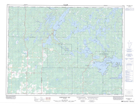
052C13 Northwest Bay Canada topo map, 1:50,000 scale
052C13 Northwest Bay NRCAN topographic map.
Includes UTM and GPS geographic coordinates (latitude and longitude). This 50k scale map is suitable for hiking, camping, and exploring, or you could frame it as a wall map.
Printed on-demand using high resolution, on heavy weight and acid free paper, or as an upgrade on a variety of synthetic materials.
Topos available on paper, Waterproof, Poly, or Tyvek. Usually shipping rolled, unless combined with other folded maps in one order.
- Product Number: NRCAN-052C13
- Parent Topo: TOPO-052C
- Map ID also known as: 052C13, 52C13
- Unfolded Size: Approximately 26" high by 36" wide
- Weight (paper map): ca. 55 grams
- Map Type: POD NRCAN Topographic Map
- Map Scale: 1:50,000
- Geographical region: Ontario, Canada
Neighboring Maps:
All neighboring Canadian topo maps are available for sale online at 1:50,000 scale.
Purchase the smaller scale map covering this area: Topo-052C
Spatial coverage:
Topo map sheet 052C13 Northwest Bay covers the following places:
- Burnt Bay - Gill's Bay - Gloomy Cove - Halfway Inlet - Hansen's Bay - Kielczewski Bay - Lost Bay - Lyons Bay - Northwest Bay - Shaw Bay - South Bay - Sunny Cove - Whistle Bay - Buckhorn Point - Galbraith Point - Gusty Point - Monument Point - Poplar Point - Sand Point - Totem Point - Black Narrows - Burnt Narrows - Squaw Narrows - West Jackfish Narrows - Dance - Fleming - Griesinger - Kingsford - Mather - Menary - Potts - Rainy River - Richardson - Rowe - Senn - Tait - Rainy Lake 17A - Rainy Lake 17B - Rainy Lake Indian Reserve 17A - Rainy Lake Indian Reserve 17B - Réserve indienne Rainy Lake 17A - Réserve indienne Rainy Lake 17B - Allman's Island - McRae's Island - Moore Island - Whoopy Island - Abbott Lake - Albert Lake - Banana Lake - Beadle Lake - Benninger Lake - Biddison Lake - Bone Lake - Boundary Lake - Box Lake - Burditt Lake - Calder Lake - Cedar Lake - Footprint Lake - Hoey Lake - Jackfish Lake - Jackfish Lake - Lac à la Pluie - Lake Despair - Lake Hope - Little Kishkutena Lake - Little Pine Lake - Loonhaunt Lake - Manomin Lake - Mud Lake - Muskrat Lake - Nuttall Lake - Off Lake - Ottertail Lake - Panorama Lake - Pinewood Lake - Pony Lake - Potts Lake - Preachers Lake - Preachers Lake - Rainy Lake - Spencer Lake - Spring Lake - Tiny Lake - Wasaw Lake - West Jackfish Lake - Whidden Lake - Yoker Lake - Chapple - Kingsford - Jackfish Rapids - Long Rapids - Whitehorse Rapids - Biddison Creek - Bremner Creek - Christie Creek - Crazy Jack Creek - Footprint River - Log Creek - Loonhaunt River - Lost Creek - Manomin River - Mile River - Pinewood River - Stamp Creek - Sturgeon Creek - Wasaw Creek - Whitehorse River - Albert Lake Portage - Footprint Portage - Hope Portage - Loon Portage - Northwest Portage - Ottertail Portage - Black Hawk - Burditt Lake - Dance - Finland - Government Landing - Manomin - Northwest Bay - Off Lake Corner


