
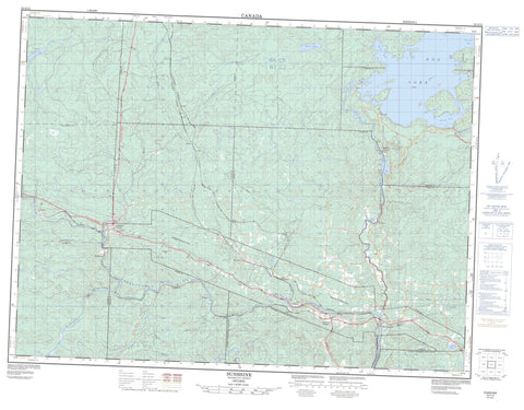
052A12 Sunshine Canada topo map, 1:50,000 scale
052A12 Sunshine NRCAN topographic map.
Includes UTM and GPS geographic coordinates (latitude and longitude). This 50k scale map is suitable for hiking, camping, and exploring, or you could frame it as a wall map.
Printed on-demand using high resolution, on heavy weight and acid free paper, or as an upgrade on a variety of synthetic materials.
Topos available on paper, Waterproof, Poly, or Tyvek. Usually shipping rolled, unless combined with other folded maps in one order.
- Product Number: NRCAN-052A12
- Parent Topo: TOPO-052A
- Map ID also known as: 052A12, 52A12
- Unfolded Size: Approximately 26" high by 36" wide
- Weight (paper map): ca. 55 grams
- Map Type: POD NRCAN Topographic Map
- Map Scale: 1:50,000
- Geographical region: Ontario, Canada
Neighboring Maps:
All neighboring Canadian topo maps are available for sale online at 1:50,000 scale.
Purchase the smaller scale map covering this area: Topo-052A
Spatial coverage:
Topo map sheet 052A12 Sunshine covers the following places:
- Buda Bay - Hawk Bay - Stirrett Bay - Bad Point - Dog Falls - High Falls - Lower Falls - Silver Falls - Blackwell - Forbes - Fowler - Goldie - Horne - Laurie - Soper - Ware - Bolduc Lake - Cowles Lake - Dog Lake - Gold Lake - Hadwen Lake - Little Dog Lake - Mokomon Lake - Mud Lake - Thunder Lake - Oliver - Oliver Paipoonge - Paipoonge - Silver Falls Provincial Park - Crooked Rapids - Paddys Rapids - Depot Creek - Drift Creek - East Oskondaga River - Hawkeye Creek - Kaministikwia River - Kaministiquia River - Matawin River - Oskondaga River - Portage Creek - Portage Creek - Shebandowan River - Strawberry Creek - Sunshine Creek - Wiegand River - The Liftover - Buda - Conmee - Dog River - Ellis - Finmark - Flett - Glenwater - Griff - Kaministikwia - Kaministiquia - Mabella - Oskondaga - Shabaqua - Shabaqua Corners - Sistonens Corners - Sunshine


