
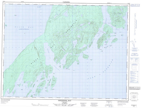
052A09 Shesheeb Bay Canada topo map, 1:50,000 scale
052A09 Shesheeb Bay NRCAN topographic map.
Includes UTM and GPS geographic coordinates (latitude and longitude). This 50k scale map is suitable for hiking, camping, and exploring, or you could frame it as a wall map.
Printed on-demand using high resolution, on heavy weight and acid free paper, or as an upgrade on a variety of synthetic materials.
Topos available on paper, Waterproof, Poly, or Tyvek. Usually shipping rolled, unless combined with other folded maps in one order.
- Product Number: NRCAN-052A09
- Parent Topo: TOPO-052A
- Map ID also known as: 052A09, 52A9, 52A09
- Unfolded Size: Approximately 26" high by 36" wide
- Weight (paper map): ca. 55 grams
- Map Type: POD NRCAN Topographic Map
- Map Scale: 1:50,000
- Geographical region: Ontario, Canada
Neighboring Maps:
All neighboring Canadian topo maps are available for sale online at 1:50,000 scale.
Purchase the smaller scale map covering this area: Topo-052A
Spatial coverage:
Topo map sheet 052A09 Shesheeb Bay covers the following places:
- Agate Cove - Black Bay - Clark Bay - Jean Pierre Bay - Loon Harbour - Marcil Bay - Moss Harbour - Otter Cove - Pleasant Harbour - Root Bay - Shesheeb Bay - Squaw Bay - Sturgeon Bay - Zeolite Bay - Agate Point - Beeton Point - Black Bay Peninsula - Herron Point - Jean Pierre Point - Newash Point - Roche Debout Point - Root Point - Shesheeb Point - Starke Point - Stowe Point - Zeolite Point - Blind Channel - Devil's Gap - Nipigon Strait - Owen Channel - Roche Debout Channel - Arthur Island - Bachand Island - Bill & Jim Islands - Birch Island - Blaisdell Island - Borden Island - Bourbonnais Island - Brodeur Island - Cedar Island - Chapleau Island - Coutlee Island - Davies Island - Fluor Island - Ford Island - Gordon Island - Gourdeau Island - Granite Island - Green Island - Hanbury Island - Hawk Island - Helen Island - Hood Island - Irvine Island - Jobin Island - Lamb Island - Lasher Island - Lowrey Island - McKay Island - Montgomery Island - Mood Island - Mystery Island - Newton Island - Otter Island - Provost Island - Puff Island - Pugsley Island - Rex Island - Sarah Island - Sarrat Island - Spain Island - Spar Island - St. Ignace Island - Swede Island - Tisdall Island - Tremblay Island - Willard Island - Broom Lake - Dawson Lake - Iron Lake - Lake Superior - Laurie Lake - Moss Lake - Moss Lake - Otter Lake - Schelling Lake - Shelling Lake - Puff Island Provincial Nature Reserve - Shesheeb Bay Provincial Nature Reserve - Dawson Creek - Sturgeon River - Dacres Rock - Foxhound Rock - Girard Rock - Manuel Rock - McGhie Rock - Newcombe Rock - Sail Rock - Schank Rock - Sovereign Rock


