
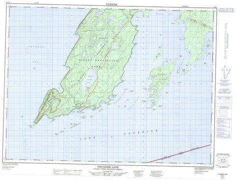
052A07 Thunder Cape Canada topo map, 1:50,000 scale
052A07 Thunder Cape NRCAN topographic map.
Includes UTM and GPS geographic coordinates (latitude and longitude). This 50k scale map is suitable for hiking, camping, and exploring, or you could frame it as a wall map.
Printed on-demand using high resolution, on heavy weight and acid free paper, or as an upgrade on a variety of synthetic materials.
Topos available on paper, Waterproof, Poly, or Tyvek. Usually shipping rolled, unless combined with other folded maps in one order.
- Product Number: NRCAN-052A07
- Parent Topo: TOPO-052A
- Map ID also known as: 052A07, 52A7, 52A07
- Unfolded Size: Approximately 26" high by 36" wide
- Weight (paper map): ca. 55 grams
- Map Type: POD NRCAN Topographic Map
- Map Scale: 1:50,000
- Geographical region: Ontario, Canada
Neighboring Maps:
All neighboring Canadian topo maps are available for sale online at 1:50,000 scale.
Purchase the smaller scale map covering this area: Topo-052A
Spatial coverage:
Topo map sheet 052A07 Thunder Cape covers the following places:
- Black Bay - Camp Bay - Clavet Bay - Cowie Bay - Edward Harbour - Finlay Bay - Fork Bay - Hoorigan Bay - Horseshoe Cove - Middlebrun Bay - Miles Bay - Osler Bay - Perry Bay - Pringle Bay - Sawyer Bay - Schell Bay - Sibley Bay - Sibley Cove - Squaw Bay - Tee Harbour - Thunder Bay - Black Bay Peninsula - Church Point - Clavet Point - Cowie Point - Demers Point - Finlay Point - Foster Point - George Point - Hoorigan Point - Kidd Point - Magnet Point - Middlebrun Point - Point Porphyry - Sibley Peninsula - The Sea Lion - Thunder Cape - Magnet Channel - Middlebrun Channel - Montreal Channel - Nana Steps - Sibley - Anorthite Islet - Ariel Island - Arno Island - Burnt Island - Clark Island - Cranberry Island - Doris Island - Dreadnought Island - Edward Island - Emmerson Island - Gravel Island - Grey Island - Hardscrabble Island - Hare Island - Longtin Island - Magnet Island - Marvin Island - Mary Island - Middlebrun Island - Monk Island - Phlox Island - Porphyry Island - Pyritic Island - Sand Islands - Shangoina Island - Ship Island - Silver Islet - Silver Islet - Skinaway Island - Sybill Island - Trowbridge Island - Tunnel Island - Addison Lake - Berryblue Lake - Calcite Lake - Crest Lake - Demers Lake - Ferns Lake - Gardner Lake - Grassy Lake - Helen Lake - Holt Lake - Joeboy Lake - Kay Lake - Lac Supérieur - Lake Superior - Legend Lake - Little Surprise Lake - Lizard Lake - Marie Louise Lake - Norma Lake - Norwegian Lake - Otter Lake - Pickerel Lake - Pounsford Lake - Ravine Lake - Red Sandstone Lake - Rita Lake - Roadside Lake - Sawbill Lake - Scum Lake - Shale Lake - Shuniah Lake - Sibleymount Lake - Sifting Lake - Surprise Lake - Talus Lake - Tarn Lake - Twinpine Lake - Verandah Lake - Wampum Lake - The Adams Apple - The Breast - The Chest - The Head - The Paps - The Sleeping Giant - The Triangle - Thunder Mountain - Shuniah - Edward Island Provincial Nature Reserve - Porphyry Island Provincial Nature Reserve - Porphyry Island Provincial Park - Sleeping Giant Provincial Park - Sleeping Giant Wilderness Area - Gardner Creek - Joe Creek - Joeboy Creek - Marie Louise Creek - Marie Louise Creek - Pickerel Creek - Sawbill Creek - Sibley Creek - Carney Rock - Copp Rock - Crosse Rocks - Hare Island Reef - Lennox Rock - Little Gibraltar Rock - Majestic Rock - Maloney Shoal - Porphyry Reef - Seagram Rock - Sloan Bank - Turriff Patch - Silver Islet


