
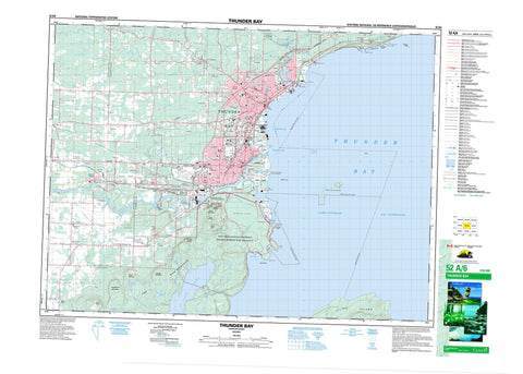
052A06 Thunder Bay Canada topo map, 1:50,000 scale
052A06 Thunder Bay NRCAN topographic map.
Includes UTM and GPS geographic coordinates (latitude and longitude). This 50k scale map is suitable for hiking, camping, and exploring, or you could frame it as a wall map.
Printed on-demand using high resolution, on heavy weight and acid free paper, or as an upgrade on a variety of synthetic materials.
Topos available on paper, Waterproof, Poly, or Tyvek. Usually shipping rolled, unless combined with other folded maps in one order.
- Product Number: NRCAN-052A06
- Parent Topo: TOPO-052A
- Map ID also known as: 052A06, 52A6, 52A06
- Unfolded Size: Approximately 26" high by 36" wide
- Weight (paper map): ca. 55 grams
- Map Type: POD NRCAN Topographic Map
- Map Scale: 1:50,000
- Geographical region: Ontario, Canada
Neighboring Maps:
All neighboring Canadian topo maps are available for sale online at 1:50,000 scale.
Purchase the smaller scale map covering this area: Topo-052A
Spatial coverage:
Topo map sheet 052A06 Thunder Bay covers the following places:
- Brûlé Bay - Fort William Harbour - Green Bay - Lakehead Harbour - Mission Bay - Port Arthur Harbour - Squaw Bay - Thunder Bay - Thunder Bay Harbour - Green Bay Beach - Wild Goose Beach - Bare Point - Grand Point - Green Point - McNab Point - Melancon Point - Pointe de Meuron - Whiskyjack Point - Wild Goose Point - Wildgoose Point - Fort William - Port Arthur - The Lakehead - Thunder Bay - Trowbridge Falls - Blake - MacGregor - McIntyre - Neebing - Oliver - Paipoonge - Neebing McIntyre Floodway - Fort William 52 - Fort William Indian Reserve 52 - Réserve indienne Fort William 52 - McKellar Island - Mission Island - Mutton Island - Papoose Islands - Pie Island - Squaw Island - Welcome Islands - Boulevard Lake - Crescent Lake - Horseshoe Lake - Johnson Lake - Lac Supérieur - Lake Superior - Loch Lomond - McQuaig Lake - Moon Lake - Sawdust Lake - Champ de tir Mount McKay - Mount McKay Range - Mount Godfrey - Mount Hurlburt - Mount Johnson - Mount Matchett - Mount McKay - Mount McQuaig - Mount McRae - Mount Rose - Squaretop Mountain - Sugarloaf Hill - The Nor'Westers - Oliver - Oliver Paipoonge - Paipoonge - Shuniah - Cascades Conservation Area - Mission Island Marsh Conservation Area - Mission Flats - Blind Creek - Current River - Kaministikwia River - Kaministiquia River - Lomond River - McIntyre Creek - McIntyre River - McIntyre River - McKellar River - McQuaig Creek - McVicar Creek - Mission River - Mosquito Creek - Neebing River - Newton Creek - North Current River - Otter Creek - Savigny Creek - Sawdust Creek - Slate River - Whiskyjack Creek - Wild Goose Creek - Wildgoose Creek - Burke Shoal - Grand Reef - Mutton Shoal - Old Dumping Ground Shoal - Schwitzer Shoal - Welcome Shoal - Neebing - Baird - Carters Corners - Intola - Jelly - Jumbo Gardens - McCluskeys Corners - Mission Village - Moose Hill - Murillo - Navilus - Neebing - Neebing Yard - North McIntyre - Prince Arthur's Landing - Rosslyn Village - Slate River Valley - Twin City - Vickers Heights - West Fort William - Wild Goose - Neebing Marsh


