
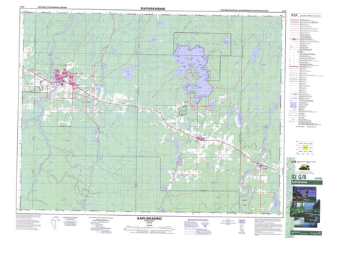
042G08 Kapuskasing Canada topo map, 1:50,000 scale
042G08 Kapuskasing NRCAN topographic map.
Includes UTM and GPS geographic coordinates (latitude and longitude). This 50k scale map is suitable for hiking, camping, and exploring, or you could frame it as a wall map.
Printed on-demand using high resolution, on heavy weight and acid free paper, or as an upgrade on a variety of synthetic materials.
Topos available on paper, Waterproof, Poly, or Tyvek. Usually shipping rolled, unless combined with other folded maps in one order.
- Product Number: NRCAN-042G08
- Parent Topo: TOPO-042G
- Map ID also known as: 042G08, 42G8, 42G08
- Unfolded Size: Approximately 26" high by 36" wide
- Weight (paper map): ca. 55 grams
- Map Type: POD NRCAN Topographic Map
- Map Scale: 1:50,000
- Geographical region: Ontario, Canada
Neighboring Maps:
All neighboring Canadian topo maps are available for sale online at 1:50,000 scale.
Purchase the smaller scale map covering this area: Topo-042G
Spatial coverage:
Topo map sheet 042G08 Kapuskasing covers the following places:
- Air Base Bay - Bare Butt Bay - Bradley Bay - Crawfish Cove - East Bay - Fishermen's Bay - Gagnon's Bay - Girdlestone Bay - Kitigan Bay - Ouellette's Bay - Outlet Bay - Peninsula Bay - Picnic Bay - Portage Bay - Research Bay - Round Bay - Vanrassel Bay - Bond's Point - Crooked Point - Gable Point - Gamble's Point - Leblanc's Point - Lefebvre Peninsula - Lefebvre Point - Myer's Point - Necking Point - North Cape - Phipps Point - Pickerel Point - Remi Peninsula - Rocky Point - Scott's Point - Scout Point - Spruce Point - Walker's Point - Weldon's Point - West Peninsula - Windy Point - Inner Channel - Outer Channel - Spruce Falls - Sturgeon Falls - Beardmore - Fauquier - Gurney - Machin - Nansen - O'Brien - Owens - Shackleton - Sulman - Swanson - Teetzel - Williamson - Airplane Island - Ant Island - Baker Island - Bray's Island - Bremner Island - Buehl Island - Buell Island - Cimon's Island - Clavelle's Island - Dead Man's Island - Duck Island - Hazel Island - Jet Island - Lyons Island - Rudd Island - Seymour Island - Stoughton's Island - Audrey Lake - Aurel Lake - Balsam Lake - Beavertail Lake - Bonner Lake - Bouchard Lake - Brack Lake - Cantin Lake - Clear Lake - Clear Lake - Crawfish Lake - D'Amour Lake - D'Armour Lake - Duck Lake - Fanning Lake - Foss Lake - Gauthier Lake - Grass Lake - Gravel Lake - Guenette Lake - Hastings Lake - Hay Lake - Hennessy Lake - Kluck Lake - Lac Batiste - Lac Brochet - Lac Charette - Lac Orignal - Lac Rémi - Lily Lake - Line Lake - Little Audrey Lake - Mac Lake - Marten Lake - Meilleur Lake - Muskrat Lake - Nansen Lake - Newfeld Lake - North Tower Lake - O'Brien Lake - Perch Lakes - Poplar Lake - Potvin Lake - Proulx Lake - Remi Lake - South Hay Lake - South Tower Lake - Spruce Lake - Swanson Lake - Tower Lake - Tower Lake - Watersnake Lake - West Audrey Lake - Fauquier - Fauquier-Strickland - Moonbeam - Owens, Williamson and Idington - Shackleton and Machin - Val Rita-Harty - Rene Brunelle Provincial Park - René Brunelle Provincial Park - Audrey Creek - Bass Creek - Beaver Creek - Beavertail Creek - D'Amour Creek - Gauthier Creek - Gough Creek - Grass Creek - Groundhog River - Hastings Creek - Hennessy Creek - Kapuskasing River - Kitigan River - Lily Creek - Lily River - Little Wabicock Creek - Marten Creek - Moonshine Creek - Nansen Creek - O'Brien Creek - Remi River - Rivière de Kapuskasing - Rivière Groundhog - Rivière Saganash - Saganash River - South Nansen Creek - Spruce Creek - Wabicock Creek - Watersnake Creek - Wellington Creek - West Audrey Creek - Gull Rock - Kapuskasing - Brunetville - Eastview - Fauquier - Glenwood - Kitigan - Moonbeam - Northfield - River Heights - Val Albert - West Riverside


