
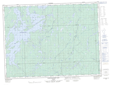
042C16 Kabinakagami Lake Canada topo map, 1:50,000 scale
042C16 Kabinakagami Lake NRCAN topographic map.
Includes UTM and GPS geographic coordinates (latitude and longitude). This 50k scale map is suitable for hiking, camping, and exploring, or you could frame it as a wall map.
Printed on-demand using high resolution, on heavy weight and acid free paper, or as an upgrade on a variety of synthetic materials.
Topos available on paper, Waterproof, Poly, or Tyvek. Usually shipping rolled, unless combined with other folded maps in one order.
- Product Number: NRCAN-042C16
- Parent Topo: TOPO-042C
- Map ID also known as: 042C16, 42C16
- Unfolded Size: Approximately 26" high by 36" wide
- Weight (paper map): ca. 55 grams
- Map Type: POD NRCAN Topographic Map
- Map Scale: 1:50,000
- Geographical region: Ontario, Canada
Neighboring Maps:
All neighboring Canadian topo maps are available for sale online at 1:50,000 scale.
Purchase the smaller scale map covering this area: Topo-042C
Spatial coverage:
Topo map sheet 042C16 Kabinakagami Lake covers the following places:
- Beaver Bay - Boot Bay - Burnt Bay - Five Mile Bay - Goulet Bay - Little Kaby Bay - Little Whitefish Bay - Pine Portage Bay - Rocky Bay - Schist Bay - Simon's Bay - Whitefish Bay - Alligator Point - Big Point - Driller's Point - Picard's Point - Wigwam Point - Windy Point - Agamik Gap - First Gap - Fourth Gap - Second Gap - Third Gap - Jumper Falls - Carney - Derry - Ermine - Hawkins - Irving - Lipton - Lizar - Marjorie - Martin - Mildred - Mosambik - Walls - Agamik Island - Birch Island - Blueberry Island - Burnt Island - Dog Island - John's Island - Moose Island - Twenty Pound Island - Agamapashik Lake - Akron Lakes - Ankrom Lake - Beaver Lake - Bullmoose Lake - Cameron Lake - Carney Lake - Dana Lake - Dubroy Lake - Ermine Lake - Evelyn Lake - Gull Lake - Hawkins Lake - Hilliard Lake - Irving Lake - Kabinakagami Lake - Kabinakagamisis Lake - Langdon Lake - Little Akron Lake - Little Carney Lake - Little Coat Lake - Little Ermine Lake - Little Pichogen Lake - Little Watt Lake - Lost Lake - Marjorie Lake - Moose Lake - Pichogen Lake - Pine Portage Lake - Rat Lake - Sharpe Lake - The Expansion - Upper Pichogen Lake - First Rapids - Gull Rapids - Second Rapids - Third Rapids - Trout Rapids - Akron Creek - Bear Creek - Breckenridge Creek - Carney Creek - Coat River - Dana Creek - Ermine Creek - Fairy Creek - Five Mile Creek - Hawkins Creek - Irving Creek - Kabinakagami River - Kabinakagamisis River - Lipton Creek - Little Akron Creek - Little Coat River - Noisy Creek - Oba River - Sharpe Creek - Stoney Creek - Swanson Creek - Watt Creek - Chain of Lakes Portage - Five Mile Portage - Pine Portage - Gull Rock - Akron - Dana - Langdon - Price


