
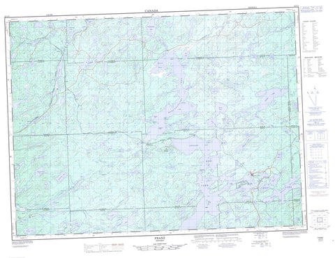
042C08 Franz Canada topo map, 1:50,000 scale
042C08 Franz NRCAN topographic map.
Includes UTM and GPS geographic coordinates (latitude and longitude). This 50k scale map is suitable for hiking, camping, and exploring, or you could frame it as a wall map.
Printed on-demand using high resolution, on heavy weight and acid free paper, or as an upgrade on a variety of synthetic materials.
Topos available on paper, Waterproof, Poly, or Tyvek. Usually shipping rolled, unless combined with other folded maps in one order.
- Product Number: NRCAN-042C08
- Parent Topo: TOPO-042C
- Map ID also known as: 042C08, 42C8, 42C08
- Unfolded Size: Approximately 26" high by 36" wide
- Weight (paper map): ca. 55 grams
- Map Type: POD NRCAN Topographic Map
- Map Scale: 1:50,000
- Geographical region: Ontario, Canada
Neighboring Maps:
All neighboring Canadian topo maps are available for sale online at 1:50,000 scale.
Purchase the smaller scale map covering this area: Topo-042C
Spatial coverage:
Topo map sheet 042C08 Franz covers the following places:
- Core Shack Bay - Eagle Bay - Eagle Nest Bay - Emily Bay - Fifty Seven Bay - Greenhorn Bay - Hay Bay - Indian Bay - Kathleen Bay - Lochalsh Bay - Moose Bay - Patterson Bay - Poacher's Bay - Sandy Bay - Sixty One Bay - Tie Bay - Bear Point - Patterson Point - Dog Lake Narrows - The Narrows - 25,26 - 26,26 - 27,26 - 44 - 45 - 46 - 47 - 48 - 49 - 51 - 52 - Acton - Aguonie - Bird - Bruyere - Challener - Copenace - Finan - Glasgow - Huotari - Jacobson - Leguerrier - Marsh - Meath - Pearkes - Rennie - Riggs - St. Julien - Stover - West - Winget - Missanabie 62 - Missanabie Indian Reserve 62 - Réserve indienne Missanabie 62 - Carpenter's Island - Chris Island - Fox Island - Mildred's Island - Patterson Island - Rabbit Island - Acme Lake - Aitken Lake - Albert Lake - Allen Lake - Aloft Lake - Annex Lake - Argo Lake - Arm Lake - Barry Lake - Bearpaw Lake - Beaver Lake - Blackout Lake - Boss Lake - Bren Lake - Brothers Lake - Burns Lake - Camp Lake - Carter Lake - Cawdron Lake - Chin Lake - Cline Lake - Cormick Lake - Cradle Lakes - Crouch Lake - Dobbs Lake - Dog Lake - Dreany Lake - Easey Lake - Eighty Four Lake - Elbow Lake - End Lake - Eskay Lake - Esnagi Lake - Factor Lake - Fifty Nine Lake - Florence Lake - Gilbert Lake - Glasgow Lake - Godin Lake - Goudreau Lake - Haf Lake - Hal Lake - Harcourt Lake - Hobon Lake - Horgon Lake - Indian Lake - Iserhoff Lake - Island Lake - Jaeger Lake - Jane Lake - Jean Lake - Joan Lake - June Lake - Justin Lake - Knee Lake - Lac Goudreau - Lanceley Lake - Leg Lake - Little Brothers Lake - Little Godin Lake - Little Peckerwood Lake - Loch Katrine - Loch Lomond - Long Lake - Loughlin Lake - Lovell Lake - Lucy Lake - Macamic Lake - Mal Lake - Martin Lake - Maskinonge Lake - McKee Lake - McKewen Lake - Meath Lake - Miller Lake - Moorhouse Lake - Morrison Lake - Mountain Lake - Murray Lake - Old Cabin Lake - Otter Lake - Paddy's Lake - Peckerwood Lake - Pine Lake - Pinny Lake - Poon Lake - Racicot Lake - Ren Lake - Rocky Lake - Rosa Lake - Saturday Lake - Shehan Lake - Sleek Lake - Souliere Lake - Spring Lake - Squaw Lake - St. Julien Lake - Strobus Lake - Stuart Lake - Summit Lake - Tavis Lake - Teachers Lake - Teare Lake - Trout Lake - Tuff Lake - Wabatongushi Lake - Webb Lake - Manitou Mountain - Brothers Creek - Butler Creek - Cawdron Creek - Cormick Creek - Cradle Creek - Crouch Creek - Dog River - Fitzpatrick Creek - Goudreau Creek - Hobon Creek - Little Brothers Creek - Lochalsh River - McKee Creek - McVeigh Creek - Peckerwood Creek - Stover Creek - Tehoama River - Twin Rocks - Franz - Gutelius - Lochalsh - Missanabie - Otter - Pick - Wanda


