
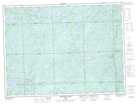
042C07 Medhurst Creek Canada topo map, 1:50,000 scale
042C07 Medhurst Creek NRCAN topographic map.
Includes UTM and GPS geographic coordinates (latitude and longitude). This 50k scale map is suitable for hiking, camping, and exploring, or you could frame it as a wall map.
Printed on-demand using high resolution, on heavy weight and acid free paper, or as an upgrade on a variety of synthetic materials.
Topos available on paper, Waterproof, Poly, or Tyvek. Usually shipping rolled, unless combined with other folded maps in one order.
- Product Number: NRCAN-042C07
- Parent Topo: TOPO-042C
- Map ID also known as: 042C07, 42C7, 42C07
- Unfolded Size: Approximately 26" high by 36" wide
- Weight (paper map): ca. 55 grams
- Map Type: POD NRCAN Topographic Map
- Map Scale: 1:50,000
- Geographical region: Ontario, Canada
Neighboring Maps:
All neighboring Canadian topo maps are available for sale online at 1:50,000 scale.
Purchase the smaller scale map covering this area: Topo-042C
Spatial coverage:
Topo map sheet 042C07 Medhurst Creek covers the following places:
- Cross Bay - Perry Bay - Jean Falls - 27,26 - 28,26 - 28,27 - 29,26 - 29,27 - 30,26 - 30,27 - 31,26 - 31,27 - 49 - 52 - 53 - 54 - 55 - 56 - 61 - 62 - 63 - Abotossaway - Aguonie - Ashley - Atkinson - Bernst - Broughton - Carmody - Chenard - Dahl - Dambrossio - Dumas - Dunphy - Finan - Huotari - Knicely - Lalibert - Leclaire - McGowan - Pearkes - Tilston - Aitken Lake - Alabama Lake - Alexandra Lake - Bare Tent Lake - Big Ben Lake - Boulder Lake - Brant Lake - Davies Lake - Delusion Lake - Desolation Lake - Dickenson Lake - Dipneedle Lake - Dreany Lake - East Middleton Lake - Elbow Lake - Elmo Lake - Elsie Lake - Esnagi Lake - Falls Lake - Fish Hook Lake - Floating Rock Lake - Friendly Lake - Fungus Lake - Goldie Lake - Grasett Lake - Grayling Lake - Green Lake - Herbage Lake - Herman Lake - Iris Lake - Jackson Lake - Kabenung Lake - Kapimchigama Lake - Lac à Nadeau - Lac Saucisse - Lanier Lake - Leach Lake - Little Tilston Lake - Lola Lake - Lonely Lake - Lower Lola Lake - Lower Medhurst Lake - Lund Lake - Marsh Lake - Medhurst Lake - Mud Lake - Mystery Lake - Nadeau Lake - Negwazu Lake - Newcombe Lake - Nicho Lake - Otto Lake - Pashoskoota Lake - Philip Lake - Princess Lake - Radford Lake - Rainbow Lake - Rogers Lake - Ruthelda Lake - Ryerson Lake - Sausage Lake - Sherman Lake - Smithy Lake - Souloup Lake - Spotted Lake - Square Lake - Summit Lake - Summit Lake - Sutherland Lake - Syenite Lake - Tea Lake - Tilston Lake - Tray Lake - Tripoli Lake - Troupe Lake - Twin Lakes - Upper Fungus Lake - Upper Lola Lake - Wabenung Lake - West Tripoli Lake - White Water Lily Lake - Willigar Lake - Wysor Lake - Dubreuilville - Toolong Rapids - Amyot Creek - Crayfish Creek - Crique Tripoli - Delusion Creek - Desolation Creek - Evans Creek - Fungus Creek - Herman Creek - Hobon Creek - Kabinakagami River - Magpie River - McVeigh Creek - Medhurst Creek - Peckerwood Creek - Princess Creek - Rivière Magpie - Ryerson Creek - Soderston Creek - Tea Creek - Tilston Creek - Tripoli Creek - Grand Portage - Amyot - Girdwood - Goudreau - Grasett - Ryerson - Swanson - Tripoli


