
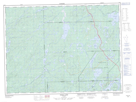
042C06 Pokei Lake Canada topo map, 1:50,000 scale
042C06 Pokei Lake NRCAN topographic map.
Includes UTM and GPS geographic coordinates (latitude and longitude). This 50k scale map is suitable for hiking, camping, and exploring, or you could frame it as a wall map.
Printed on-demand using high resolution, on heavy weight and acid free paper, or as an upgrade on a variety of synthetic materials.
Topos available on paper, Waterproof, Poly, or Tyvek. Usually shipping rolled, unless combined with other folded maps in one order.
- Product Number: NRCAN-042C06
- Parent Topo: TOPO-042C
- Map ID also known as: 042C06, 42C6, 42C06
- Unfolded Size: Approximately 26" high by 36" wide
- Weight (paper map): ca. 55 grams
- Map Type: POD NRCAN Topographic Map
- Map Scale: 1:50,000
- Geographical region: Ontario, Canada
Neighboring Maps:
All neighboring Canadian topo maps are available for sale online at 1:50,000 scale.
Purchase the smaller scale map covering this area: Topo-042C
Spatial coverage:
Topo map sheet 042C06 Pokei Lake covers the following places:
- No Fish Bay - Perry Bay - 31,26 - 31,27 - 32,26 - 32,27 - 32,28 - 33 Additional, 26 - 33,26 - 33,27 - 33,28 - 56 - 63 - 64 - 65 - Alanen - Ashley - Chapais - Charbonneau - Dahl - Keating - Keating Additional - Killins - Knicely - McDowell - McGowan - Memaskwosh - Thunder Bay - Vasiloff - Iserhoff Island - Star Island - Beaver Lake - Bogle Lake - Burnfield Lake - Charlotte Lake - Coronation Lake - Cotton Lake - Crayfish Lake - Cushing Lake - Dennison Lake - Doss Lake - Gibson Lake - Hammer Lake - Heart Lake - Jarvey Lake - Kabenung Lake - Knife Lake - Line Lake - Lower Pokei Lake - Marianne Lake - Marion Lake - McCrea Lake - McMaster Lake - McQuown Lake - Moki Lake - Negwazu Lake - Nemategun Lake - Nichols Lake - North McCrea Lake - Obatanga Lake - Okoko Lake - One Island Lake - Parkinson's Pothole - Patron Lake - Pokei Lake - Raymond Lake - Sad Lake - Saniga Lake - Soulier Lake - South Hammer Lake - Spriggs Lake - University Lake - West Kabenung Lake - Whitefish Lake - Wilder Lake - Heart Mountain - Kabenung Hills - Morse Mountain - Obatanga Provincial Park - Pokei Lake/White River Wetlands Provincial Nature Reserve - Pokei Lake/White River Wetlands Provincial Park - Pukaskwa River Provincial Park - Coronation Creek - Crayfish Creek - Dog (University) River - Dog River - Doss Creek - East Bremner River - Knife Creek - McQuown Creek - Obatanga Creek - Okoko Creek - Pokei Creek - Pukaskwa River - University River - White River - Wilder Creek - Birch


