
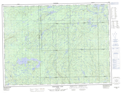
042C03 Mishibishu Lake Canada topo map, 1:50,000 scale
042C03 Mishibishu Lake NRCAN topographic map.
Includes UTM and GPS geographic coordinates (latitude and longitude). This 50k scale map is suitable for hiking, camping, and exploring, or you could frame it as a wall map.
Printed on-demand using high resolution, on heavy weight and acid free paper, or as an upgrade on a variety of synthetic materials.
Topos available on paper, Waterproof, Poly, or Tyvek. Usually shipping rolled, unless combined with other folded maps in one order.
- Product Number: NRCAN-042C03
- Parent Topo: TOPO-042C
- Map ID also known as: 042C03, 42C3, 42C03
- Unfolded Size: Approximately 26" high by 36" wide
- Weight (paper map): ca. 55 grams
- Map Type: POD NRCAN Topographic Map
- Map Scale: 1:50,000
- Geographical region: Ontario, Canada
Neighboring Maps:
All neighboring Canadian topo maps are available for sale online at 1:50,000 scale.
Purchase the smaller scale map covering this area: Topo-042C
Spatial coverage:
Topo map sheet 042C03 Mishibishu Lake covers the following places:
- Minnesota Bay - No Fish Bay - Red Pine Point - 31,23 - 31,24 - 31,25 - 31,26 - 32,23 - 32,24 - 32,25 - 32,26 - 33 Additional, 25 - 33 Additional, 26 - 33,23 - 33,24 - 33,25 - 33,26 - André - Bostwick - Franchère - Groseilliers - Keating - Keating Additional - Killins - Knicely - Legarde - Legarde Additional - Levesque - Macaskill - St. Germain - Thunder Bay - Warpula - Iserhoff Island - Star Island - Abbie Lake - Ambrose Lake - Augusta Lake - Back Lake - Betty Lake - Bog Lake - Bowman Lake - Brian Lake - Cameron Lake - Charlies Lake - Clearwater Pond - Clifftay Lake - Dud Lake - Eaglet Lake - Ellen Lake - Floating Heart Lake - Fly Lake - Harrison Lake - Heart Lake - Iron Lake - Isabella Lake - Jimmy Kash Lake - Jostle Lake - Katzenbach Lake - Lac à la Plonge - Lac aux Cypres - Little Beaver Lake - Marjorie Lake - Marjory Lake - Miron Lake - Mishi Lake - Mishibishu Lake - Missing Lake - Nichols Lake - Ore Lake - Paint Lake - Rook Lake - Sad Lake - Sage Lake - Spendunc Lake - Spring Lake - Upper Jimmy Kash Lake - Warbedeelius Lake - West Kabenung Lake - Yaskovitch Lake - Yvonne Lake - Brotherton Hill - Frances Hill - Maidens Leap Mountain - Mount Raymond - Nimoosh Provincial Park - Widgeon Lake Moraine Conservation Reserve - Dog (University) River - Dog River - Dud Creek - Eagle River - East Pukaskwa River - Farwell Creek - Feather River - Floating Heart River - Iron Creek - Jimmy Kash River - Little Bear River - Macassa Creek - Makwa River - Mishi Creek - Mobert Creek - Paint Creek - Stares Creek - University River - Wilder Creek


