
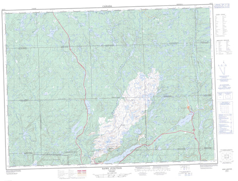
042C02 Hawk Junction Canada topo map, 1:50,000 scale
042C02 Hawk Junction NRCAN topographic map.
Includes UTM and GPS geographic coordinates (latitude and longitude). This 50k scale map is suitable for hiking, camping, and exploring, or you could frame it as a wall map.
Printed on-demand using high resolution, on heavy weight and acid free paper, or as an upgrade on a variety of synthetic materials.
Topos available on paper, Waterproof, Poly, or Tyvek. Usually shipping rolled, unless combined with other folded maps in one order.
- Product Number: NRCAN-042C02
- Parent Topo: TOPO-042C
- Map ID also known as: 042C02, 42C2, 42C02
- Unfolded Size: Approximately 26" high by 36" wide
- Weight (paper map): ca. 55 grams
- Map Type: POD NRCAN Topographic Map
- Map Scale: 1:50,000
- Geographical region: Ontario, Canada
Neighboring Maps:
All neighboring Canadian topo maps are available for sale online at 1:50,000 scale.
Purchase the smaller scale map covering this area: Topo-042C
Spatial coverage:
Topo map sheet 042C02 Hawk Junction covers the following places:
- Blue Bay - Cedar Falls - Steephill Falls - 27,23 - 27,24 - 27,25 - 27,26 - 28,23 - 28,24 - 28,25 - 28,26 - 29,23 - 29,24 - 29,25 - 29,26 - 30,23 - 30,24 - 30,25 - 30,26 - 31,23 - 31,24 - 31,25 - 31,26 - Abotossaway - Aguonie - André - Bailloquet - Bostwick - Chabanel - Corbiere - Cowie - Esquega - Fiddler - Knicely - Lalibert - Lastheels - Leclaire - Lendrum - Macaskill - Maness - McMurray - Menzies - Musquash - Gros Cap Indian Reserve 49 - Réserve indienne Gros Cap 49 - Jasper Island - Shist Island - Aitken Lake - Alabama Lake - Alden Lake - Alice Lake - Allen Lake - American Cabin Lake - Andre Lake - Arliss Lake - Bauldry Lake - Betty Lake - Big Lake - Big Marsh Lake - Billboy Lake - Black Trout Lake - Blasko Lake - Blue Lake - Blueberry Lake - Bob Lake - Bog Lake - Bremner Lake - Brooks Lake - Byron Lake - Catfish Lake - Clearview Lake - Cliff Lake - Cruise Lake - Cuthbertson Lake - Deacon Lake - Dickenson Lake - Dill Lake - Dipneedle Lake - Doherty Lake - Doré Lake - East Middleton Lake - Elbow Lake - Emerald Lake - Emily Lake - Endless Lake - Eva Lake - Finger Lake - Fish Hook Lake - Francis Lake - Furnival Lake - Garbe Lake - Ghost Lake - Godon Lake - Goetz Lake - Grant Lake - Gutcher Lake - Hawk Lake - Holdsworth Lake - Huge Lake - Ireland Lake - Irene Lake - Jackson Lake - Josephine Lake - Kapimchigama Lake - Kilkenny Lake - Kimbal Lake - Kozak Lake - Lac Wawa - Lagarde Lake - Leg Lake - Lena Lake - Little Soulier Lake - Loonskin Lake - Lost Sky Pilot Lake - Lund Lake - Mack Lake - Maguire Lake - Mall Lake - Manitowik Lake - Mary Lake - McCormick Lake - McEwen Lake - McKechnie Lake - Middleton Lake - Mildred Lake - Mink Lake - Molybdenite Lake - Moran Lake - Mosquito Lake - Murphy Lake - Nancy Lake - Otter Lake - Parks Lake - Pashoskoota Lake - Perry Lake - Pike Lake - Porphyry Lake - Punk Lake - Rainbow Lake - Reua Lake - Reynolds Lake - Roddy Lake - Rowan Lake - Ruth Lake - Sayer Lake - Scott Lake - Selkirk Lake - Shook Lake - Siderite Lake - Speight Lake - Spud Lake - Summit Lake - Sunrise Lake - Swallow Lake - Talbot Lake - Twin Lakes - Vanreek Lake - Walbank Lake - Wallace Lake - Wasp Lake - Wawa Lake - West Andre Lake - Wishbone Lake - Michipicoten - Magpie River Terraces Conservation Reserve - Andre Creek - Billboy Creek - Black Trout Creek - Catfish Creek - Crayfish Creek - Dill River - Doré River - Evans Creek - Firesand River - Forge Creek - Garbe Creek - Hawk River - Josephine Creek - Lena Creek - Little Catfish Creek - Magpie River - McVeigh Creek - Molybdenite Creek - Paint Creek - Rivière Magpie - Grand Portage - Alden - Hawk Junction - Helen Junction - Helen Mine - Josephine - Magpie - Magpie Mine - Siderite Junction - Wawa


