
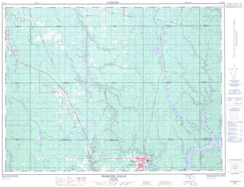
042A15 Iroquois Falls Canada topo map, 1:50,000 scale
042A15 Iroquois Falls NRCAN topographic map.
Includes UTM and GPS geographic coordinates (latitude and longitude). This 50k scale map is suitable for hiking, camping, and exploring, or you could frame it as a wall map.
Printed on-demand using high resolution, on heavy weight and acid free paper, or as an upgrade on a variety of synthetic materials.
Topos available on paper, Waterproof, Poly, or Tyvek. Usually shipping rolled, unless combined with other folded maps in one order.
- Product Number: NRCAN-042A15
- Parent Topo: TOPO-042A
- Map ID also known as: 042A15, 42A15
- Unfolded Size: Approximately 26" high by 36" wide
- Weight (paper map): ca. 55 grams
- Map Type: POD NRCAN Topographic Map
- Map Scale: 1:50,000
- Geographical region: Ontario, Canada
Neighboring Maps:
All neighboring Canadian topo maps are available for sale online at 1:50,000 scale.
Purchase the smaller scale map covering this area: Topo-042A
Spatial coverage:
Topo map sheet 042A15 Iroquois Falls covers the following places:
- Iroquois Falls - Aurora - Brower - Calvert - Cochrane - Edwards - Fox - Hanna - Lamarche - Little - Mann - McCart - Mortimer - Newmarket - Pyne - Rickard - Sherring - St. John - Stimson - Sweatman - Teefy - Timiskaming - Wesley - Alpine Lake - Byrnes Lake - Childs Lake - Cole Lake - Devils Punch Bowl Lake - Devonshire Lake - Doucette Lake - Evelyn Lake - Fletchers Lake - Freve Lake - Frontier Lake - Gaffney Lake - Hanna Lake - Herman Lake - Jeannie Lake - Jefferson Lake - Joseph Lake - Lefroy Lake - Little Gaffney Lake - Little Lake - Maloney Lake - Mary Lake - Moseley Lake - Nellie Lake - Otter Lake - Pool Lake - Sak Lake - Siamese Twins Lake - Sibbald Lake - Taylors Lake - Tom Lake - Tricketts Lake - Warrick Lake - Withington Lake - Woolley Lake - Calvert - Glackmeyer - Nahma Bog and Poor Fens Conservation Reserve - Buckdeer Rapids - Abitibi River - Brower Creek - Coté Creek - Crique Édouard - Devonshire Creek - Edwards Creek - Flint Creek - Frederick House River - Hanna Creek - Hudson Creek - Meadow Creek - Mistango River - Paton Creek - Pickerel Creek - Rivière Abitibi - Rivière Mistango - Sak Creek - Sucker River - Wesley Creek - West Mistango River - Wicklow Creek - Wicklow River - Cochrane - Iroquois Falls - Ansonville - Arpin - Berylvale - Devonshire - Downard - Montrock - Nellie Lake - Niddville - Norembega - Potter - Stimson - Stimson Diamond - Tunis - Twin Falls


