
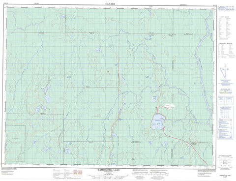
042A12 Kamiskotia Lake Canada topo map, 1:50,000 scale
042A12 Kamiskotia Lake NRCAN topographic map.
Includes UTM and GPS geographic coordinates (latitude and longitude). This 50k scale map is suitable for hiking, camping, and exploring, or you could frame it as a wall map.
Printed on-demand using high resolution, on heavy weight and acid free paper, or as an upgrade on a variety of synthetic materials.
Topos available on paper, Waterproof, Poly, or Tyvek. Usually shipping rolled, unless combined with other folded maps in one order.
- Product Number: NRCAN-042A12
- Parent Topo: TOPO-042A
- Map ID also known as: 042A12, 42A12
- Unfolded Size: Approximately 26" high by 36" wide
- Weight (paper map): ca. 55 grams
- Map Type: POD NRCAN Topographic Map
- Map Scale: 1:50,000
- Geographical region: Ontario, Canada
Neighboring Maps:
All neighboring Canadian topo maps are available for sale online at 1:50,000 scale.
Purchase the smaller scale map covering this area: Topo-042A
Spatial coverage:
Topo map sheet 042A12 Kamiskotia Lake covers the following places:
- Fire Rangers Point - Wallingford Point - Timmins - Timmins-Porcupine - Kamiskotia Falls - Aitken - Byers - Cochrane - Côté - Enid - Fortune - Godfrey - Jamieson - Loveland - Macdiarmid - Massey - Moberly - Reid - Robb - Thorburn - Timiskaming - Turnbull - Flying Post Indian Reserve 73 - Réserve indienne Flying Post 73 - Bamboo Lake - Blue Lake - Byers Lake - Christmas Lake - Enid Lake - Footprint Lakes - Fortune Lake - Halfmoon Lake - Horseshoe Lake - Kamiskotia Lake - Little Enid Lake - Little Massey Lake - Loveland Lake - Lower Footprint Lake - Maggie's Lake - Marcy Lake - Massey Lake - McCrae Lake - Moberly Lake - New Years Lake - Rankin Lake - Ronson Lake - Round Lake - Steep Lake - Upper Footprint Lake - West Commando Lake - Winter Lake - Byers Mountain - Coad Hill - Kamiskotia Hill - Mount Jamieson - Mount Rutledge - Whitepine Hill - Mountjoy - Tisdale - Whitney - Aitken Creek - Bartlett Creek - Byers Creek - Christmas Creek - Enid Creek - Godfrey Creek - Harriet Creek - Kamiskotia River - Little Enid Creek - Little Kamiskotia River - Loveland Creek - Macdiarmid Creek - Massey Creek - Mattagami River - Nat River - Rivière Mattagami - Robb Creek - Thorburn Creek - Twentysix Mile Creek - Twentythree Mile Creek - Winter Creek - Kamiskotia


