
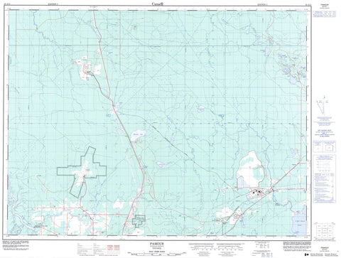
042A11 Pamour Canada topo map, 1:50,000 scale
042A11 Pamour NRCAN topographic map.
Includes UTM and GPS geographic coordinates (latitude and longitude). This 50k scale map is suitable for hiking, camping, and exploring, or you could frame it as a wall map.
Printed on-demand using high resolution, on heavy weight and acid free paper, or as an upgrade on a variety of synthetic materials.
Topos available on paper, Waterproof, Poly, or Tyvek. Usually shipping rolled, unless combined with other folded maps in one order.
- Product Number: NRCAN-042A11
- Parent Topo: TOPO-042A
- Map ID also known as: 042A11, 42A11
- Unfolded Size: Approximately 26" high by 36" wide
- Weight (paper map): ca. 55 grams
- Map Type: POD NRCAN Topographic Map
- Map Scale: 1:50,000
- Geographical region: Ontario, Canada
Neighboring Maps:
All neighboring Canadian topo maps are available for sale online at 1:50,000 scale.
Purchase the smaller scale map covering this area: Topo-042A
Spatial coverage:
Topo map sheet 042A11 Pamour covers the following places:
- Cemetery Point - Wilfred Poirier Point - Timmins - Timmins-Porcupine - Sandy Falls - Carnegie - Cochrane - Cody - Evelyn - Godfrey - Gowan - Hoyle - Jamieson - Jessop - Kidd - Little - Macdiarmid - Matheson - Mountjoy - Murphy - Prosser - Reid - Timiskaming - Tisdale - Tully - Wark - Whitney - Bell Lake - Bigwater Lake - Bouchard Lake - Boundary Lake - Charlebois Lake - Clearwater Lake - Dipper Lake - Duck Lake - Dugwal Pit - Evelyn Lake - Feldman Lake - Gowanmarsh Lake - Hersey Lake - Ice Chest Lake - Ice Chisel Lake - Lac Charlebois - Little Goose Lake - Lizard Lake - Moon Lake - Murphy Lake - Nerandeau Lake - Night Hawk Lake - Nighthawk Lake - Noted Lake - Partridge Lake - Pick Lake - Roma Lake - Rota Lake - Roy Lake - Three Nations Lake - Mountjoy - Tisdale - Whitney - Bell Creek - Buskegau River - Craft Creek - Goose Creek - Gowanmarsh Creek - Jocko Creek - Kidd Creek - Little Goose Creek - Little Waterhen Creek - Macdiarmid Creek - Matheson Creek - Mattagami River - Moose Creek - Murphy Creek - North Porcupine River - Porcupine River - Rivière Mattagami - Rota Creek - Twentythree Mile Creek - Waterhen Creek - West Buskegau River - Broulan Reef - Dugwal - Hallnor - Hill's Landing - Hoyle - Keyson - Pamour - Sandy Falls


