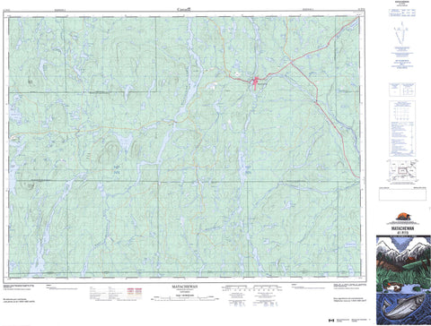
041P15 Matachewan Canada topo map, 1:50,000 scale
041P15 Matachewan NRCAN topographic map.
Includes UTM and GPS geographic coordinates (latitude and longitude). This 50k scale map is suitable for hiking, camping, and exploring, or you could frame it as a wall map.
Printed on-demand using high resolution, on heavy weight and acid free paper, or as an upgrade on a variety of synthetic materials.
Topos available on paper, Waterproof, Poly, or Tyvek. Usually shipping rolled, unless combined with other folded maps in one order.
- Product Number: NRCAN-041P15
- Parent Topo: TOPO-041P
- Map ID also known as: 041P15, 41P15
- Unfolded Size: Approximately 26" high by 36" wide
- Weight (paper map): ca. 55 grams
- Map Type: POD NRCAN Topographic Map
- Map Scale: 1:50,000
- Geographical region: Ontario, Canada
Neighboring Maps:
All neighboring Canadian topo maps are available for sale online at 1:50,000 scale.
Purchase the smaller scale map covering this area: Topo-041P
Spatial coverage:
Topo map sheet 041P15 Matachewan covers the following places:
- Fraser Bay - Rankin Bay - Roche Bay - Bannockburn - Cairo - Chown - Doon - Farr - Flavelle - Haultain - Kimberley - Knight - Mickle - Midlothian - Montrose - Morel - Powell - Rankin - Raymond - Shillington - Timiskaming - Van Hise - Willison - Yarrow - Bell Island - Fraser Island - Roche Island - Stanley Island - Tom Island - Amos Lake - Andy Lake - Banner Lake - Bannockburn Lake - Betsy Lake - Birch Lake - Blake Lake - Bloom Lake - Bray Lake - Cameroon Lake - Charlewood Lake - Clarke Lake - Cleaver Lake - Cockburn Lake - Cop Lake - Cow Lake - Crotch Lake - Dara Lake - Davidson Lake - Donaldson Lake - Dora Lake - Duncan Lake - Eagle Lake - Edgar Lake - Elizabeth Lake - Elmer Lake - Fox Lake - Fred Lake - Georgina Lake - Gump Lake - Haultain Lake - Hawley Lake - Heron Lake - Highbluff Lake - Hilda Lake - Hildreth Lake - Hollinger Lake - Hoover Lake - Hunt Lake - Jean Lake - Kame Lake - Kawakanika Lake - Knott Lake - Lac St-Paul - Lakoma Lake - Larry Lake - Lavigne Lake - Lehmann Lake - Lipton Lake - Little Hawley Lake - Lloyd Lake - Log Lake - Lowbluff Lake - Lower Matachewan Lake - Maher Lake - Markie Lake - Markle Lake - Matachewan Lake - Middleton Lake - Midlothian Lake - Miriam Lake - Mistinikon Lake - Moosecall Lake - Morrison Lake - Mount Sinclair Lake - Moyneur Lake - Mudpack Lake - Obobke Lake - Orphan Lake - Otisse Lake - Pardich Lake - Penassi Lake - Piper Lake - Portage Lake - Ragan Lake - Rahn Lake - Rankin Lake - Roche Lake - Ryan Lake - Sanderson Lake - Shillington Lake - Sisseney Lake - Snowtrail Lake - St. Paul Lake - Swampy Lake - Sydney Lake - Tom Lake - Tommy Lake - Twitchgrass Lake - Vipond Lake - Webb Lake - Whiskeyjack Lake - Wolferstan Lake - Wookey Lake - Yarrow Lake - Zigzag Lake - Zurbrigg Lake - Mount Collins - Mount Sinclair - Matachewan - Matachewan - Mistinikon Lake Uplands Conservation Reserve - West Montreal River Provincial Park - Flat Rapids - Fox Rapids - Long Rapids - Moyneur Rapids - Oldwoman Rapids - Bannockburn Creek - Calcite Creek - Cleaver Creek - Davidson Creek - Deadmoose Creek - Duncan Creek - Elizabeth Creek - Elmer Creek - Hawley Creek - Heron Creek - Hilda Creek - McDonnel Creek - Middleton Creek - Montreal River - Powell Creek - St. Paul Creek - Sydney Creek - West Montreal River - Whiskeyjack Creek - Whitefish River - The Forks - Fort Matachewan - Matachewan


