
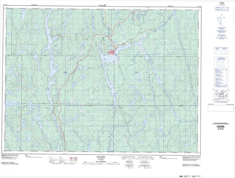
041P12 Gogama Canada topo map, 1:50,000 scale
041P12 Gogama NRCAN topographic map.
Includes UTM and GPS geographic coordinates (latitude and longitude). This 50k scale map is suitable for hiking, camping, and exploring, or you could frame it as a wall map.
Printed on-demand using high resolution, on heavy weight and acid free paper, or as an upgrade on a variety of synthetic materials.
Topos available on paper, Waterproof, Poly, or Tyvek. Usually shipping rolled, unless combined with other folded maps in one order.
- Product Number: NRCAN-041P12
- Parent Topo: TOPO-041P
- Map ID also known as: 041P12, 41P12
- Unfolded Size: Approximately 26" high by 36" wide
- Weight (paper map): ca. 55 grams
- Map Type: POD NRCAN Topographic Map
- Map Scale: 1:50,000
- Geographical region: Ontario, Canada
Neighboring Maps:
All neighboring Canadian topo maps are available for sale online at 1:50,000 scale.
Purchase the smaller scale map covering this area: Topo-041P
Spatial coverage:
Topo map sheet 041P12 Gogama covers the following places:
- Benneweis Bay - Cochrane's Bay - East Arm - Moose Bay - Sandy Portage Bay - South Arm - Southcamp Bay - West Arm - Goulais Point - Poplar Point - The Notch - Benneweis - Brunswick - Champagne - Chester - Frater - Groves - Jack - Londonderry - Neville - Noble - Potier - Somme - St. Louis - Togo - Yeo - Gervais Island - Payette's Island - Rock Island - A Lake - Amelia Lake - Annex Lake - Aragon Lake - Attach Lake - B Lake - Bagsverd Lake - Beaver Lake - Benneweis Lake - Bernice Lake - Billie Lake - Boundary Lake - Chain Lake - Champagne Lake - Chester Lake - Chute Lake - Clam Lake - Claus Lake - Colleen Lake - Côté Lake - Delaney Lake - Dividing Lake - Doris Lake - Duckbreast Lake - Errington Lake - Farm Lake - Frigid Lake - Geoffrion Lake - George Lake - Groves Lake - Halfway Lake - Hanover Lake - Helen Lake - Irene Lake - Jessica Lake - Kihzik Lake - Kizhik Lake - LaMotte Lake - Little Clam Lake - Little Shuller Lake - Little Wizard Lake - Londonderry Lake - Lorry Lake - Lost Lake - Loucks Lake - Lucienne Lake - Makami Lake - Makwa Lake - Mattagami Lake - Mesomikenda Lake - Minisinakwa Lake - Mollie Lake - Moore Lake - Muskeg Lake - Neville Lake - Octave Lake - Pembroke Lake - Pensyl Lake - Piggott Lake - Rene Lake - Robitaille Lake - Robitaille Lake - Round Lake - Sawpeter Lake - Schist Lake - Schou Lake - Shuller Lake - Skidway Lake - Somme Lake - Spruce Lake - St. Louis Lake - Susanne Lake - Tahill Lake - Tate Lake - Three Duck Lakes - Turnip Lake - Twin Lakes - Twin Lakes - Upper St. Louis Lake - Vendette Lake - Weeduck Lake - Whalsom Lake - Wizard Lake - Wolf Lake - La Motte Lake Provincial Park - Makwa Rapids - Togo Rapids - Aragon Creek - Bagsverd Creek - Beaver Creek - Benneweis Creek - Bernice Creek - Clam Creek - Donnegana River - Errington Creek - Hanover Creek - Kenetogami Creek - LaMotte Creek - Lawson's Creek - Little Mollie Creek - Makami River - Makwa Creek - Minisinakwa River - Mollie River - Nabakwasi River - Noble River - Pembroke Creek - Pensyl Creek - Piggott Creek - Shuller Creek - Somme River - St. Louis Creek - Whalsom Creek - Wizard Creek - Gogama - Makwa


