
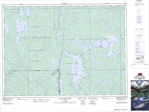
041P08 Lady Evelyn Lake Canada topo map, 1:50,000 scale
041P08 Lady Evelyn Lake NRCAN topographic map.
Includes UTM and GPS geographic coordinates (latitude and longitude). This 50k scale map is suitable for hiking, camping, and exploring, or you could frame it as a wall map.
Printed on-demand using high resolution, on heavy weight and acid free paper, or as an upgrade on a variety of synthetic materials.
Topos available on paper, Waterproof, Poly, or Tyvek. Usually shipping rolled, unless combined with other folded maps in one order.
- Product Number: NRCAN-041P08
- Parent Topo: TOPO-041P
- Map ID also known as: 041P08, 41P8, 41P08
- Unfolded Size: Approximately 26" high by 36" wide
- Weight (paper map): ca. 55 grams
- Map Type: POD NRCAN Topographic Map
- Map Scale: 1:50,000
- Geographical region: Ontario, Canada
Neighboring Maps:
All neighboring Canadian topo maps are available for sale online at 1:50,000 scale.
Purchase the smaller scale map covering this area: Topo-041P
Spatial coverage:
Topo map sheet 041P08 Lady Evelyn Lake covers the following places:
- Redpine Point - Snake Point - Obashingwakoba Narrows - Obisaga Narrows - Obowanga Narrows - Waswaning Narrows - Centre Falls - Frank Falls - Helen Falls - Auld - Banks - Barr - Brigstocke - Cole - Dane - Kittson - Klock - Leo - Lundy - McGiffin - Medina - Rorke - Selby - Sladen - Speight - Timiskaming - Trethewey - van Nostrand - Wallis - Whitson - Mattawapika Island - Aneroid Lake - Angler Lake - Anvil Lake - Arabella Lake - Bach Lake - Banks Lake - Barter Lake - Beatrice Lake - Bercole Lake - Bergeron Lake - Bessie Lake - Big Bilsky Lake - Big Boot Lake - Buff Lake - Cebush Lake - Chris Willis Lake - Coag Lake - Cole Lake - Cuni Lake - Darby Lake - Diabase Lake - Dry Lake - Duncanson Lake - Eagle Lake - East Kidd Lake - Frogfly Lake - Gladys Lake - Globe Lake - Goldie Lake - Goodfish Lake - Grassy Lake - Graymud Lake - Grays Lake - Greenwater Lake - Gut Lake - Hammer Lake - Handel Lake - Hobart Lake - Holden Lake - Inez Lake - Isbister Lake - Jim Edwards Lake - Katherine Lake - Kerry Lake - Klock Lake - Lady Evelyn Lake - Lady Sydney Lake - Landers Lake - Little Skull Lake - Lockie Lake - Lynx Lake - Macpherson Lake - Makobe Lake - McGiffin Lake - Moccasin Lake - Morin Lake - Niccolite Lake - Old Bill Lake - Planet Lake - Rookery Lake - Shallow Lake - Sherwood Lake - Sirdevan Lake - Skull Lake - Slade Lake - Small Island Lake - Sonny Lake - Stonehenge Lake - Sucker Gut Lake - Sugar Lake - Swampgrass Lake - Trethewey Lake - Tupper Lake - Turner Lake - Upper Kerry Lake - Verdi Lake - Walsh Lake - Willow Island Lake - Wolfskin Lake - Young Loon Lake - Maple Mountain - East Lady Evelyn Lake Conservation Reserve - Indian Bay South Conservation Reserve - Jim Edwards Lake Conservation Reserve - Lady Evelyn-Smoothwater Provincial Park - Obabika River Provincial Park - Sugar Lake Conservation Reserve - Eagle River - Edwards Creek - Grays River - Kerry Creek - Lady Evelyn River - Makobe River - Moccasin Creek - Montreal River - Muskego River - Nasmith Creek - North Lady Evelyn River - South Lady Evelyn River - Wakimika River - Willow Island Creek


