
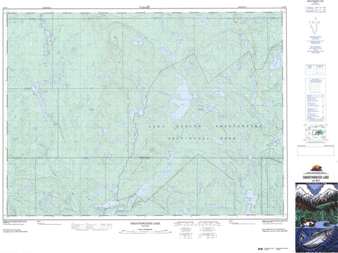
041P07 Smoothwater Lake Canada topo map, 1:50,000 scale
041P07 Smoothwater Lake NRCAN topographic map.
Includes UTM and GPS geographic coordinates (latitude and longitude). This 50k scale map is suitable for hiking, camping, and exploring, or you could frame it as a wall map.
Printed on-demand using high resolution, on heavy weight and acid free paper, or as an upgrade on a variety of synthetic materials.
Topos available on paper, Waterproof, Poly, or Tyvek. Usually shipping rolled, unless combined with other folded maps in one order.
- Product Number: NRCAN-041P07
- Parent Topo: TOPO-041P
- Map ID also known as: 041P07, 41P7, 41P07
- Unfolded Size: Approximately 26" high by 36" wide
- Weight (paper map): ca. 55 grams
- Map Type: POD NRCAN Topographic Map
- Map Scale: 1:50,000
- Geographical region: Ontario, Canada
Neighboring Maps:
All neighboring Canadian topo maps are available for sale online at 1:50,000 scale.
Purchase the smaller scale map covering this area: Topo-041P
Spatial coverage:
Topo map sheet 041P07 Smoothwater Lake covers the following places:
- Bowland Falls - McKee Falls - Brewster - Charters - Corkill - Corley - Donovan - Dufferin - Ellis - Gamble - Leckie - Leith - Leonard - McGiffin - McLeod - North Williams - Parker - Ray - Selby - Stull - Timiskaming - Trethewey - Wallis - Airplane Lake - Apex Lake - Aurora Lake - Banak Lake - Barr Lake - Bond Lake - Bootleg Lake - Brace Lake - Canthook Lake - Carmen Lake - Chalice Lake - Chance Lake - Church Lake - Collins Lake - Compass Lake - Conolly Lake - Contact Lake - Crown Lake - Desert Lake - Dick Lake - Duff Lake - Durkee Lake - Eleanor Lake - Elissa Lake - Finlay Lake - Florence Lake - Fly Lake - Frog Lake - Gagnon Lake - Gamble Lake - Gooseneck Lake - Grey Lake - Hamlow Lake - Hollow Cedar Lake - Horseshoe Lake - Jawbone Lake - Jerry Lake - Kaa Lake - Kenneth Lake - Kidd Lake - Kite Lake - Lady Dufferin Lake - Lamy Lake - Little Aurora Lake - Little Scarecrow Lake - Little Whitepine Lake - Lofty Lake - Lulu Lake - Madden Lake - Marina Lake - McAra Lake - McCulloch Lake - McKee Lake - McQuah Lake - Mihell Lake - Mile Lake - Mirror Lake - Mooserun Lake - North Yorston Lake - O'Gormon Lake - Okiniada Lake - Pack Lake - Paddle Lake - Parent Lake - Perch Lake - Plier Lake - Rack Lake - Rawleigh Lake - Reekie Lake - Rent Lake - Scarecrow Lake - Shack Lake - Smith Lake - Smoothwater Lake - Spear Lake - Spoon Lake - Steele Lake - Step Lake - Stull Lake - Sunnywater Lake - Tent Lake - Theodore Lake - Thomson Lake - Togo Lake - Tremble Lake - Trethewey Lake - Upper Stull Lake - Wabun Lake - Weedend Lake - Whirligig Lake - White Pine Lake - Whitemud Lake - Whitepine Lake - Wiltsey Lake - Wishbone Lake - Woods Lake - Worry Lake - Yankee Lake - Ishpatina Hills - Ishpatina Ridge - Brace Creek Outwash Plain Conservation Reserve - Jim Edwards Lake Conservation Reserve - Lady Evelyn-Smoothwater Provincial Park - North Yorston Conservation Reserve - Smith Lake Conservation Reserve - Sturgeon River Provincial Park - Wapus Creek Conservation Reserve - Brace Creek - Desert Creek - East Wapus Creek - Florence River - Fly Creek - Haines Creek - Jerry Creek - Kidd Creek - Kite Creek - Lulu Creek - McKee Creek - Montreal River - Nasmith Creek - North Lady Evelyn River - Okiniada Creek - Oshawatagan Creek - Plier Creek - Rivière Wanapitei - Scarecrow Creek - Shack Creek - Silvester Creek - Smith Creek - South Lady Evelyn River - Stull Creek - Sturgeon River - Tent Creek - Upper Pilgrim Creek - Wanapitei River - Wapus Creek - Wishbone Creek - Yorston River


