
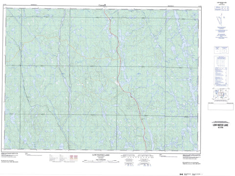
041P04 Low Water Lake Canada topo map, 1:50,000 scale
041P04 Low Water Lake NRCAN topographic map.
Includes UTM and GPS geographic coordinates (latitude and longitude). This 50k scale map is suitable for hiking, camping, and exploring, or you could frame it as a wall map.
Printed on-demand using high resolution, on heavy weight and acid free paper, or as an upgrade on a variety of synthetic materials.
Topos available on paper, Waterproof, Poly, or Tyvek. Usually shipping rolled, unless combined with other folded maps in one order.
- Product Number: NRCAN-041P04
- Parent Topo: TOPO-041P
- Map ID also known as: 041P04, 41P4, 41P04
- Unfolded Size: Approximately 26" high by 36" wide
- Weight (paper map): ca. 55 grams
- Map Type: POD NRCAN Topographic Map
- Map Scale: 1:50,000
- Geographical region: Ontario, Canada
Neighboring Maps:
All neighboring Canadian topo maps are available for sale online at 1:50,000 scale.
Purchase the smaller scale map covering this area: Topo-041P
Spatial coverage:
Topo map sheet 041P04 Low Water Lake covers the following places:
- Arrow Bay - Green Bay - Loon Bay - Muldrew Bay - Shelley Bay - Poplar Narrows - 6 - 7 - 8 - 9 - Alton - Athlone - Battersby - Baynes - Bazett - Blewett - Breadner - Brebeuf - Cavana - Chalet - Dublin - Fairbairn - LaFleche - Lillie - Marquette - Muldrew - Onaping - Paudash - Shelley - Specht - Alton Lake - Anchor Lake - Athlone Lake - Bagpipe Lake - Bat Lake - Battersby Lake - Baynes Lake - Bayshell Lake - Big Squaw Lake - Breadner Lake - Bushtail Lake - Calbeck Lake - Camp Lake - Crow Lake - Diver Lake - Doubtful Lake - Dublin Lake - Eastsand Lake - Elboga Lake - Elspie Lake - Eureka Lake - Expanse Lake - Fairbairn Lake - Fifth Lake - First Lake - Fourth Lake - Grave Lake - Gwylan Lake - Hoot Lake - Hybrid Lake - Labiche Lake - Larkin Lake - Lebell Lake - Little Otterpelt Lake - Little Squaw Lake - Low Lake - Low Water Lake - Lower Lake - Lower Muldrew Lake - Marquette Lake - McDougall Lake - McGowan Lake - McKeown Lake - Mike Lake - Mudhen Lake - Muldrew Lake - Onaping Lake - Ostrom Lake - Path Lake - Piano Lake - Pogamasing Lake - Pot Lake - Red Deer Lake - Rumsay Lake - Second Lake - St. John Lake - Third Lake - Tourville Lake - Twisted Lake - Upper Elboga Lake - Upper Green Lake - Upper Marquette Lake - Upper McGowan Lake - Upper Path Lake - Upper Path Lakes - Vondet Lake - Wapejo Lake - Weblett Lake - Onaping Lake Conservation Reserve - Spanish River Provincial Park - Athlone Creek - Battersby Creek - Baynes Creek - Breadner Creek - Dead River - Dublin Creek - East Spanish River - Eastsand River - Elboga Creek - Elspie Creek - Eureka Creek - Fairbairn Creek - Grave Creek - Hoot Creek - Hough Creek - Low Water Creek - Marquette Creek - Metagama Creek - Muldrew Creek - Otterpelt Creek - Path Creek - Paudash Creek - Pogamasing River - Red Deer Creek - Shelley Creek - Sinaminda Creek - Sinker Creek - Snake River - Spanish River - Tisdale Creek - Vondet Creek - Eureka - Forks - Metagama


