
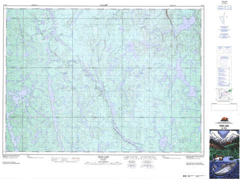
041P03 Thor Lake Canada topo map, 1:50,000 scale
041P03 Thor Lake NRCAN topographic map.
Includes UTM and GPS geographic coordinates (latitude and longitude). This 50k scale map is suitable for hiking, camping, and exploring, or you could frame it as a wall map.
Printed on-demand using high resolution, on heavy weight and acid free paper, or as an upgrade on a variety of synthetic materials.
Topos available on paper, Waterproof, Poly, or Tyvek. Usually shipping rolled, unless combined with other folded maps in one order.
- Product Number: NRCAN-041P03
- Parent Topo: TOPO-041P
- Map ID also known as: 041P03, 41P3, 41P03
- Unfolded Size: Approximately 26" high by 36" wide
- Weight (paper map): ca. 55 grams
- Map Type: POD NRCAN Topographic Map
- Map Scale: 1:50,000
- Geographical region: Ontario, Canada
Neighboring Maps:
All neighboring Canadian topo maps are available for sale online at 1:50,000 scale.
Purchase the smaller scale map covering this area: Topo-041P
Spatial coverage:
Topo map sheet 041P03 Thor Lake covers the following places:
- Arrow Bay - East Bay - Green Bay - Loon Bay - Beaumont - Beresford - Beulah - Blewett - Cotton - Dunbar - Fairbairn - Frechette - Hodgetts - Howey - Lampman - Leask - Marshay - McNamara - Onaping - Scotia - Shelley - Stull - Sweeny - Unwin - Valin - Appelo Lake - Avery Lake - Ayotte Lake - Bailey Lake - Balsam Lake - Barnet Lake - Birch Lake - Bob Lake - Burwash Lake - Camp Lake - Camp Lake - Coonie Lake - Crystal Lake - Danae Lake - Dua Lake - Dunbar Lake - Edna Lake - Eli Lake - Esker Lake - Felix Lake - Fisher Lake - Grave Lake - Graveyard Lake - Groom Lake - Gwylan Lake - Harrison Lake - Hazen Lake - Helen Lake - Kalaco Lake - Kamenisa Lake - Ladyfair Lake - Laforest Lake - Leask Lake - Little Avery Lake - Little Beaver Lake - Little Burwash Lake - Little Dunbar Lake - Little Friday Lake - Little Helen Lake - Little Pilon Lake - Little Prune Lake - Little Tillie Lake - Lue Lake - Macsmith Lake - McNamara Lake - Menzie Lake - Metig Lake - Monday Lake - Muddle Lake - Nahnun Lake - Neewin Lake - Ningoowaswi Lake - North Coonie Lake - North Helen Lake - North Sweeney Lake - North Sweeny Lake - Odin Lake - Onaping Lake - Oshawong Lake - Pazhig Lake - Pilon Lake - Post Lake - Prune Lake - Raphoe Lake - Rome Lake - Sandplain Lake - Satu Lake - Scotia Lake - Seagull Lake - Shack Lake - Shelley Lake - Shoofly Lake - Sloe Lake - Solo Lake - South Hazen Lake - South Odin Lake - South Sweeney Lake - South Sweeny Lake - South Wrench Lake - Stevenson Lake - Sunday Lake - Thor Lake - Thorbass Lake - Three Mile Lake - Tillie Lake - Tramp Lake - Unwin Lake - Upper Dua Lake - Welcome Lake - Wolf Lake - Wolf Lake - Wrench Lake - Zinc Lake - Friday and Scotia Lakes Conservation Reserve - Avery Creek - Barnet Creek - Burnish Creek - Burwash Creek - Coonie Creek - Dua Creek - Dunbar Creek - Hazen Creek - Helen Creek - Ladyfair Creek - Laforest Creek - Leask Creek - Little Burwash Creek - Macsmith Creek - McNamara Creek - Menzie Creek - North Helen Creek - Opikinimika River - Pazhig Creek - Pilon Creek - Prune Creek - Rhodes Creek - Rivière Vermillion - Rivière Wanapitei - Shelley Creek - Stevenson Creek - Sweeney Creek - Sweeny Creek - Tillie Creek - Unwin Creek - Vermilion River - Wanapitei River - Welcome River - Wrench Creek - Appelo - Felix - Laforest - Lapalmes - Lapalmes Spur - McKees Camp - Old Thor Lake - Thor Lake - Thorlake


