
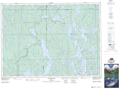
041P01 Obabika Lake Canada topo map, 1:50,000 scale
041P01 Obabika Lake NRCAN topographic map.
Includes UTM and GPS geographic coordinates (latitude and longitude). This 50k scale map is suitable for hiking, camping, and exploring, or you could frame it as a wall map.
Printed on-demand using high resolution, on heavy weight and acid free paper, or as an upgrade on a variety of synthetic materials.
Topos available on paper, Waterproof, Poly, or Tyvek. Usually shipping rolled, unless combined with other folded maps in one order.
- Product Number: NRCAN-041P01
- Parent Topo: TOPO-041P
- Map ID also known as: 041P01, 41P1, 41P01
- Unfolded Size: Approximately 26" high by 36" wide
- Weight (paper map): ca. 55 grams
- Map Type: POD NRCAN Topographic Map
- Map Scale: 1:50,000
- Geographical region: Ontario, Canada
Neighboring Maps:
All neighboring Canadian topo maps are available for sale online at 1:50,000 scale.
Purchase the smaller scale map covering this area: Topo-041P
Spatial coverage:
Topo map sheet 041P01 Obabika Lake covers the following places:
- Devil Bay - Ferguson Bay - Granny Bay - Grassy Bay - Hammerhandle Bay - Kokoko Bay - Loon Bay - Mule Bay - North Arm - Northwest Arm - Obabika Inlet - Pickerel Bay - Sandy Inlet - Sharp Rock Inlet - Spawning Bay - Whitefish Bay - Witch Bay - Devil Point - Raccoon Point - Sand Point - Sealrock Point - Squirrel Point - Acadia - Armagh - Aston - Banting - Belfast - Briggs - Brigstocke - Canton - Chambers - Clary - Cole - Cynthia - Delhi - Joan - LeRoche - Medina - Nipissing - Seagram - Selby - Shelburne - Sladen - Timiskaming - Beaver Island - Deer Island - Devil Island - Garden Island - Granny Island - Horseshoe Island - Long Island - Rabbitnose Island - Redpine Island - Snake Island - Allan Lake - Aston Lake - Banana Lake - Barmac Lake - Beaverpond Lake - Birch Lake - Bob Lake - Browns Lake - Carrying Lake - Clearwater Lake - Coppersand Lake - Deep Lake - Diabase Lake - Diamond Lake - Dorothy Lake - Eye Lake - Ferrim Lake - Fry Lake - Greyowl Lake - Guppy Lake - Hillcrest Lake - Hortense Lake - Hush Hush Lake - Indigo Lake - Jumpingcat Lake - Kokoko Lake - Lady Evelyn Lake - Lahay Lake - Lake Temagami - Lake Timagami - Le Roche Lake - Liberty Lake - Little Eagle Lake - Little Fry Lake - Malloch Lake - Marcia Lake - McCarthy Lake - Moosehead Lake - Obabika Lake - Pinetorch Lake - Red Squirrel Lake - Redflat Lake - Redmountain Lake - Reynard Lake - Roko Lake - Secret Lake - Side Rock Lake - Sirdevan Lake - Small Lake - Spitzig Lake - Spout Lake - Tip Lake - Twinkle Lake - Upper Bass Lake - Wakimika Lake - Walsh Lake - Warpats Lakes - Wawiagama Lake - Whitewater Lake - Willow Island Lake - Devil Mountain - Mount Ferguson - Bob Lake Conservation Reserve - Jim Edwards Lake Conservation Reserve - Lady Evelyn-Smoothwater Provincial Park - Obabika River Provincial Park - Pinetorch Lake Conservation Reserve - Solace Provincial Park - Ames Creek - Anima Nipissing River - Eagle River - Fry Creek - Lady Evelyn River - Little Nasmith Creek - Nasmith Creek - Obabika River - Pinetorch Creek - Wakimika River - Yorston River - Sharp Rock Portage - Temagami - Camp Bigwee - Camp Cayuga - Camp Wanapitei - Keewaydin


