
041N15 Michipicoten River Canada topo map, 1:50,000 scale
041N15 Michipicoten River NRCAN topographic map.
Includes UTM and GPS geographic coordinates (latitude and longitude). This 50k scale map is suitable for hiking, camping, and exploring, or you could frame it as a wall map.
Printed on-demand using high resolution, on heavy weight and acid free paper, or as an upgrade on a variety of synthetic materials.
Topos available on paper, Waterproof, Poly, or Tyvek. Usually shipping rolled, unless combined with other folded maps in one order.
- Product Number: NRCAN-041N15
- Parent Topo: TOPO-041N
- Map ID also known as: 041N15, 41N15
- Unfolded Size: Approximately 26" high by 36" wide
- Weight (paper map): ca. 55 grams
- Map Type: POD NRCAN Topographic Map
- Map Scale: 1:50,000
- Geographical region: Ontario, Canada
Neighboring Maps:
All neighboring Canadian topo maps are available for sale online at 1:50,000 scale.
Purchase the smaller scale map covering this area: Topo-041N
Spatial coverage:
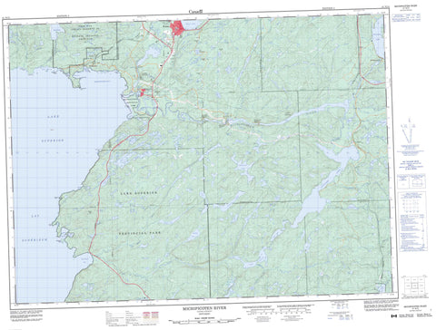
Topo map sheet 041N15 Michipicoten River covers the following places:
- Brulé Harbour - Doré Bay - Inner Harbour - Michipicoten Bay - Michipicoten Harbour - Noisy Bay - Oakes Cove - Old Woman Bay - Driftwood Beach - Gravel Beach - Indian Beach - Perraults Beach - Sandy Beach - Beauvier Point - Brulé Point - Doré Point - Mackey Point - Perkwakwia Point - Reid Point - Smoky Point - Anjigami Falls - Cat Falls - Doré Falls - Fing Falls - High Falls - Magpie Falls - McPhail Falls - Mission Falls - Scott Falls - 27,23 - 28,21 - 28,22 - 28,23 - 29,21 - 29,22 - 29,23 - 30,21 - 30,22 - 30,23 - 31,21 - 31,22 - 31,23 - Algoma - Bostwick - Dulhut - LaRonde - Lastheels - Lendrum - Maness - McMurray - Naveau - Nebonaionquet - Peterson - Rabazo - Redsky - Restoule - Gros Cap 49 - Gros Cap Indian Reserve 49 - Gros Cap Indian Village 49A - Gros Cap Indian Village Indian Reserve 49A - Réserve indienne Gros Cap 49 - Réserve indienne Gros Cap Indian Village 49A - Clergue Island - Entrance Island - Seagull Island - Ale Lake - Alpine Lake - Anderson Lake - Anjigami Lake - Anjigomi Lake - Antoine Lake - Bank Lake - Blackington Lake - Blasko Lake - Bond Lake - Bottle Lake - Bridget Lake - Broadtail Lake - Bulrush Lake - Byron Lake - Cabin Lake - Centennial Lake - Cinders Lake - Crozier Lake - Deep Lake - Dodds Lake - Doré Lake - Dossier Lake - Dycie Lake - Ear Lake - Felcite Lake - Fenton Lake - Fir Lake - Fisher Lake - Frost Lake - George Lake - Greenwood Lake - Half Mile Lake - Henry Lake - Herrick Lake - Hilltop Lake - Jubilee Lake - Junction Lake - Kashog Lake - Kearns Lake - Lac de Zajac - Lac Mishewawa - Lac Supérieur - Lac Wawa - Lake Superior - Leroy Lake - Line Lake - Little Dossier Lake - Loyda Lake - Lyre Lake - McKinney Lake - Megit Lake - Miki Lake - Mile Lake - Minto Lake - Mishewawa Lake - Mission Lake - Modden Lake - Mona Lake - Moon Lake - Moose Lake - Mountain Lake - Neilly Lake - Nezwa Lake - Noisy Lake - Norwalk Lake - Oakley Lake - Odawbi Lake - Ogas Lake - Perry Lake - Prentice Lake - Rabbit Blanket Lake - Rafter Lake - Reed Lake - Rod and Gun Lake - Roddy Lake - Roller Lake - Salter Lake - Sand Lake - Shakwa Lake - Stanley Lake - Sunrise Lake - Tabor Lake - Tenho Lake - The Pepper Lakes - Thuja Lake - Tower Lake - Treeby Lake - Twin Lakes - Two Mile Lake - Underhill Lake - Ward Lake - Wawa Lake - Whitefish Lake - Yanni Lake - Brulé Hill - Brûlé Hill - Legarde Mountain - Simmons Hill - Simon Hill - Thunder Mountain - Michipicoten - Lake Superior Provincial Park - Michipicoten Provincial Park - Michipicoten Wilderness Area - Trembley Flats - Anjigami River - Anjigomi River - Coldwater Creek - Coleman Creek - Dill River - Doré River - Dossier Creek - Firesand River - Fort Creek - Kinniwabi River - Little Makwa River - Magpie River - Michipicoten River - Moon Creek - Noisy River - Ogas Creek - Old Woman River - Perry Creek - Rivière Magpie - Sand Creek - South Old Woman River - Sponge Creek - Tabor Creek - Trout Creek - Wawa Creek - Dead River - Cat Portage - Long Portage - Anjigami - Brient - Jamestown - Limer - Michipicoten - Michipicoten Harbour - Michipicoten River - Perry - Sand Lake - Tabor - Trembley - Wawa


