
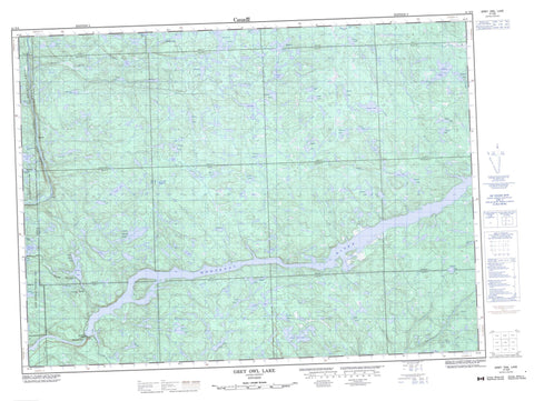
041N08 Grey Owl Lake Canada topo map, 1:50,000 scale
041N08 Grey Owl Lake NRCAN topographic map.
Includes UTM and GPS geographic coordinates (latitude and longitude). This 50k scale map is suitable for hiking, camping, and exploring, or you could frame it as a wall map.
Printed on-demand using high resolution, on heavy weight and acid free paper, or as an upgrade on a variety of synthetic materials.
Topos available on paper, Waterproof, Poly, or Tyvek. Usually shipping rolled, unless combined with other folded maps in one order.
- Product Number: NRCAN-041N08
- Parent Topo: TOPO-041N
- Map ID also known as: 041N08, 41N8, 41N08
- Unfolded Size: Approximately 26" high by 36" wide
- Weight (paper map): ca. 55 grams
- Map Type: POD NRCAN Topographic Map
- Map Scale: 1:50,000
- Geographical region: Ontario, Canada
Neighboring Maps:
All neighboring Canadian topo maps are available for sale online at 1:50,000 scale.
Purchase the smaller scale map covering this area: Topo-041N
Spatial coverage:
Topo map sheet 041N08 Grey Owl Lake covers the following places:
- Black Beaver Falls - Bridal Veil Falls - Montreal Falls - 24,15 - 24,16 - 24,17 - 24,18 - 25,15 - 25,16 - 25,17 - 25,18 - 26,15 - 26,16 - 26,17 - 26,18 - 27,16 - 27,17 - 27,18 - 28,15 - 28,16 - 28,17 - 28,18 - Algoma - Bullock - Cannard - Corboy - Eaket - Emiry - Greenwood - Grootenboer - Grzela - Hadley - Hallett - Home - Labonte - Larson - Loach - McAughey - McParland - Peever - Raaflaub - Runnalls - Running - Alvin Lake - Argosy Lake - Asp Lake - Atomic Lake - Barbara Lake - Black Beaver Lake - Bolt Lake - Buddy Lake - Bunny Lake - Carman Lake - Charlie Lake - Convey Lake - Doyle Lake - Dyer Lake - East Lake - Eleven Mile Lake - Glimmer Lake - Graft Lake - Grey Owl Lake - Gunnar Lake - Halfway Lake - Hare Lake - Haze Lake - Honey Lake - Hoppy Lake - Hubert Lake - Indian Lake - Jeff Lake - Lamb Lake - Lawrence Lake - Lionel Lake - Little Agawa Lake - Mackey Lake - Mader Lake - Magnet Lake - Mallot Lake - McCormack Lake - Mobout Lake - Mouton Lake - Nature Lake - Nesbitt Lake - Nomad Lake - North Hubert Lake - Oasis Lake - Pagent Lake - Pan Lake - Pear Lake - Pincney Lake - Pulaski Lake - Rabbit Lake - Railway Lake - Raindrop Lake - Redcliff Lake - Roderic Lake - Roi Lake - Rotunda Lake - Sad Lake - Saga Lake - Sceptic Lake - Shannon Lake - Sonny Lake - Sou Lake - Speckled Trout Lake - Stan Lake - Starlight Lake - Tikamaganda Lake - Towabanasay Lake - Union Lake - West Lake - Whistle Lake - Lake Superior Provincial Park - North Montreal River Moraine Conservation Reserve - Agawa River - Alder Creek - Batchawana River - Convey Creek - Dixon Creek - Eleven Mile Creek - Hoppy Creek - Indian River - Jeff Creek - Little Agawa River - Montreal River - Quinn River - Rabbit Creek - Sonny Creek - St. Clair Creek - Tikamaganda River - Vacher Creek - Canyon - Hubert - Montreal Falls - Agawa Canyon


