
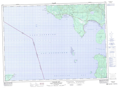
041K15 Pancake Bay Canada topo map, 1:50,000 scale
041K15 Pancake Bay NRCAN topographic map.
Includes UTM and GPS geographic coordinates (latitude and longitude). This 50k scale map is suitable for hiking, camping, and exploring, or you could frame it as a wall map.
Printed on-demand using high resolution, on heavy weight and acid free paper, or as an upgrade on a variety of synthetic materials.
Topos available on paper, Waterproof, Poly, or Tyvek. Usually shipping rolled, unless combined with other folded maps in one order.
- Product Number: NRCAN-041K15
- Parent Topo: TOPO-041K
- Map ID also known as: 041K15, 41K15
- Unfolded Size: Approximately 26" high by 36" wide
- Weight (paper map): ca. 55 grams
- Map Type: POD NRCAN Topographic Map
- Map Scale: 1:50,000
- Geographical region: Ontario, Canada
Neighboring Maps:
All neighboring Canadian topo maps are available for sale online at 1:50,000 scale.
Purchase the smaller scale map covering this area: Topo-041K
Spatial coverage:
Topo map sheet 041K15 Pancake Bay covers the following places:
- Batchawana Bay - Bluewater Bay - Cottrell Cove - Goulais Bay - Horseshoe Bay - Marlette's Bay - Nils Bay - Pancake Bay - Sand Bay - Sawpit Bay - Whitefish Bay - Coppermine Point - Corbeil Point - Grindstone Point - Pancake Point - Rudderhead Point - Sand Point - Stony Point - Whiskey Point - The Narrows - Algoma - Fisher - Herrick - Kars - Ley - Palmer - Ryan - Obadjiwan 15E - Obadjiwan Indian Reserve 15E - Réserve indienne Obadjiwan 15E - Batchawana Island - Maple Island - North Sandy Island - Rousseau Island - South Sandy Island - Steamboat Island - Carp Lake - Graham's Lake - Lac Supérieur - Lake Superior - Batchawana Bay Provincial Park - Pancake Bay Provincial Park - Sandy Islands Provincial Nature Reserve - Sandy Islands Provincial Park - Batchawana River - Black Creek - Breckenbridge Creek - Carp Creek - Carp River - East Carp River - Gimlet Creek - Pancake River - Coppermine Rock - Pancake Shoal - Parisienne Shoal - Batchawana - Batchawana Bay - Horseshoe Bay


